250th anniversary planning heats up

  • One might be surprised at paucity of info out there on the demolition of a part of the Hood Museum and the construction of a large addition. The D has a demolition photo from the Green taken last fall. Curbed.com has a post with two post-demolition photos. (See also the set of fascinating photos of the architectural model at Radii Inc.)

  • Metropolis does have a story on the Hood. These are excerpts:

    Dartmouth first began seriously mulling over the Hood’s fate in 2001, when it commissioned a speculative study by Rogers Marvel Architects. In 2005, it commissioned another by Machado Silvetti, the architectural firm that designed the Hood’s newest neighbor, the Black Family Visual Arts Center. Then in 2010, it commissioned yet another study, this time by Centerbrook, the practice that Charles Moore cofounded afterparticipatory process, which put users on a level playing field Moore Grover Harper. None created the visual presence — that new front door — that Dartmouth administrators were looking for.

    The college began soliciting proposals from a broader pool of architects. A selection committee, including faculty and administrators, winnowed down a short list. In the end, four architects were selected to be interviewed. John Scherding, director of campus design and construction, vividly remembers the TWBTA proposal:

    “All of us in the room felt it was brilliant. They were the only firm that suggested disconnecting the Hood from Wilson Hall, allowing Wilson to stand proudly on the corner of the Green. They were the only firm that showed a strong identifiable front entrance to the building, infilled the courtyard to provide program space, and really strengthened the north-south axis. It was a very powerful and simple concept that satisfied all of the needs.”

    It thoughtfully preserves the gallery spaces (one exemplary detail: To preserve the windows along the staircase, and the dance of light along the walls, TWBTA will convert some of the windows into light boxes of stained glass) and will likely improve the museum experience in many fundamental ways.

  • The sestercentennial celebration website is up. The wordmark makes some interesting typeface choices. The unique “250,” which is set in a type that might be based on Bodoni, includes the most arresting element: a numeral “2” whose diagonal (neck?) is partially erased. The numeral “5” is partially hidden by the “2,” but there is no explanation for the missing bit of the “2.” Is it meant to look like the imperfect printing of an eighteenth-century pamphlet? It looks a bit like a stencil. In any case, the “Dartmouth” on the second line is set in the official Bembo (standard Bembo, not the Yale-only version), and the third line (“1769-2019”) is set in a sans serif font.

  • The sestercentennial will involve a year-long program of events (President’s message) created by a planning committee seeking to meet a number of goals.

  • Here’s a clever little film about an interesting story: Goudy & Syracuse: The Tale of a Typeface Found.

  • Interesting insignia decisions here: the midcentury Institute of International Studies in California was acquired a few years ago by Middlebury College (Wikipedia). In 2015, Middlebury “introduced a brand identity system that embraces the full breadth of its educational endeavors by placing the Middlebury name on each of its schools and programs” (MIIS page). And what a varied collection of institutions it is, including summer schools, conferences, and academic programs. The unified identity is based on a shield. I don’t know about the Midd shield: the globe looks like it’s from a different design language, from a 1960s U.N. brochure. The chapel touches the top of the shield. The hills, because they meet the edges of the shield, read as the sleeves of a gown or as curtains. Maybe this is because the eaves of the chapel are shown as angled bars floating free on the clouds.

  • The Institute is the only Middlebury institution that gets a truly distinctive shield, a variation “that replaces the Green Mountains of Vermont and Old Chapel with the historic Segal Building from the Monterey campus and the year of the Institute’s founding” (MIIS page).

  • A Kickstarter project for Design Canada, “The first documentary chronicling the history of Canadian graphic design and how it shaped a nation and its people.”

  • The New Yorker has has an article on lines of desire. Speaking of unplanned paths, the aerial photo of the vacated pipeline protest camp in the New York Times is remarkable.

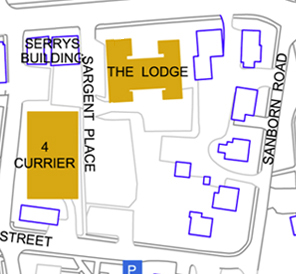
  • McGraw Bagnoli Architects have published a brochure about the firm that details the five urban design projects planned by William Rawn Associates during the early 2000s. This is fascinating. It will be interesting to see whether the school ever completes the Sargent Block project and what plan it follows.

  • Smith & Vansant have photos of some of the houses the firm has renovated for the college, including Unity House and Thayer Lodge, both on South Park Street, 26 East Wheelock, 19 South Park, and the Victorian professor’s house of the North Park House community.

  • Architect Vital Albuquerque (again, great name) < ahref="http://rwu.edu/academics/schools-colleges/saahp/portfolios/alumni/vital-albuquerque-class-01">presents more unreleased renderings of the unbuilt NCAC, including a remarkable photo of a model of the project.

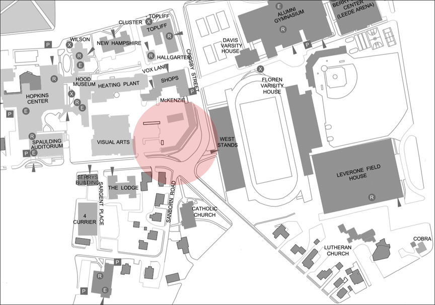
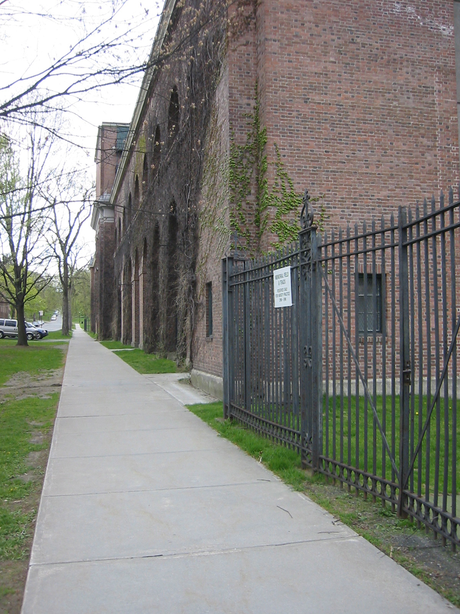
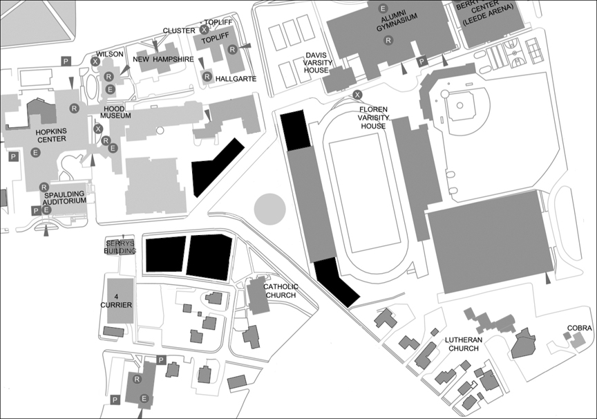
  • Engelberth Construction has its page for the West Stand Replacement up.

  • At the last board meeting,

    Hanlon outlined goals to renovate a number of aging buildings, and the board approved funds to proceed with a schematic design for the renovation of Dana Hall, the former home of the biomedical library located at the north end of campus, to facilitate the expansion and improvement of faculty office spaces.

    The board also approved a capital budget of $30 million to fund a number of projects, including the Morton Hall renovation and planning and feasibility studies of the abatement and demolition of Gilman Hall; renovations to Reed Hall and Thornton Hall; and undergraduate housing expansion and renewal.

  • A Moosilauke update with photos by Eli Burakian. The building has an interesting mix of construction techniques. Some of those “character” timbers are fantastic.

  • Some of the photos of the federal building that houses the Ninth Circuit Court of Appeals, such as the one in this New York Times story from February 9, show the elaborate metal lanterns flanking the entrance of the 1905 building. The lanterns might be familiar: architect James Knox Taylor, then Supervising Architect of the Treasury, modeled them on the torch-holders of Palazzo Strozzi in Florence of 1489 (GSA page on the Browning U.S. Court of Appeals Building). The Strozzi torch-holders also inspired Charles Rich in his design for Parkhurst Hall (1913).

  • Drove past Nervi’s SCOPE arena in Norfolk, Va. (1971-72) last weekend and admired the ribs that form the roof of this entrance pavilion (Google Street View):

Residential College details released — two temporary “commons” to be built

The college has released some information about the units that will make up the new House system (Dartmouth Now, Dartmouth Now details, The Dartmouth).

Every student will be assigned to a House randomly. (One wonders whether each House will eventually be able to choose some or all of its members.) Most new students, all of them House members, will start out living in first-year dorms: Richardson Hall, Wheeler Hall, the Fayers (North, Middle, and South Fayerweather Halls), the River (French and Judge Halls), and the Choates (Bissell, Cohen, Little, and Brown Halls). Upperclass students, all House members, will not be required to live in-House.

The House names are obviously temporary. Of the six Houses, one carries on its existing name (East Wheelock), while two are named for their locations relative to the other Houses (South and West Houses). The remaining three Houses are named, arbitrarily, for the streets on which their associated faculty residences happen to be located — just temporarily located, one hopes. For example, the Gold Coast is associated with a house being built in another part of town, on Allen Street, and so the cluster is called Allen House. The same goes for Mass Row (School Street = “School House”) and RipWoodSmith (North Park Street = “North Park House”).

These are the houses. The two temporary buildings are described in numbers 2 and 5.

  1. West House. Dorms: Fahey, McLane, Butterfield, and Russell Sage Halls. Faculty Residence: A house being built at 16 Webster Avenue, west of the President’s House. “Community” space or “commons”: Presumably the existing common area in the “hinge” in Fahey/McLane. Professor: Ryan Hickox.

    Comment: This Faculty Residence makes as much sense as any of the new Residences does.

  2. Allen House. Dorms: Gold Coast (Gile, Streeter, and Lord Halls). Faculty Residence: A house being built at 12 Allen Street, next to Panarchy. “Community” space: A temporary (lasting five to ten years) “two-level building with a snack bar and outdoor area between Gile and Hitchcock” (The D). Professor: Jane Hill.

    Comment: One hopes that eventually this House’s Professor lives in (a) Blunt, the perfect location, (b) a new house built behind the Gold Coast, where there are several great sites, or at worst (c) a new or existing house near the President’s House on Webster Avenue.

  3. School House. Dorms: Hitchcock Hall and Mass Row (North, Middle, and South Massachusetts Halls). Faculty Residence: A house being built on School Street, next to the Allen House Faculty Residence. “Community” space: The temporary building behind Hitchcock, to be shared with Allen House. Professor: Craig Sutton.

    Comment: This House’s Faculty Residence is about as distant as that of Allen House. Instead, South Fairbanks would make an ideal long-term Residence. North Fairbanks — or ’53 Commons, if it is ever not required to serve the whole college — would make an excellent “community” space.

  4. East Wheelock House. Dorms: East Wheelock Cluster (Andres, Morton, Zimmerman, and McCulloch Halls, and possibly Ledyard Apartments). Faculty Residence: Frost House/The White House (existing). “Community” space: Brace Commons (existing). House Professor: Sergi Elizalde.

    Comment: Some new students will also live here instead of in a dedicated first-year dormitory.

  5. North Park House. Dorms: RipWoodSmith (Ripley, Woodward and Smith Halls). Faculty Residence: An existing house at 3 ½ North Park Street, across from Triangle. Community space: A temporary “tent” building occuping the pair of tennis courts northwest of Davis Varsity House. It “is planned to be a ‘sprung structure,’ which generally consists of a metal arch frame with an all-weather membrane over it” (The D). Professor: Ryan Calsbeek.

    Comment: These buildings are south of the College Park and closer to two other streets than they are to North Park Street. Eventually, the college-owned Heorot house would make an ideal “community” space or Faculty Residence.

  6. South House Dorms: Topliff and New Hampshire Halls and the Lodge. Faculty Residence: A new house at 5 Sanborn Street. “Community” space: The “tent” by Davis, shared with North Park House. Professor: Kathryn Lively.

    Comment: There is a surprising amount of space west of Alumni Gym for future housing or community space, and Hallgarten would make an excellent kernel of a Faculty Residence. One hopes that the inclusion of a dorm (the Lodge) and a Faculty Residence south of Lebanon Street does not pull this grouping permanently in that direction; after the Lodge is demolished, it really must be replaced with a commercial building.

Finally, the McLaughlin Cluster (Berry, Bildner, Rauner, Byrne II, Goldstein, and Thomas Halls), while not a House, is getting a Faculty Residence (an existing house at 2 Clement Road) and a House Professor, Dennis Washburn. This group will house LLCs (Living-Learning Communities) as well as some new students who will live here instead of in a dedicated first-year dormitory. Each resident will be a nonresident member of a House located elsewhere. The Faculty Residence is relatively close, and there are good sites nearby for a future faculty house, so perhaps McL. will become a House in its own right.

map of houses

The six Houses plus one. “Community” spaces are in purple, Faculty Residences are in red, and boundaries are exaggerated to indicate (short-term?) disjointedness. Based on Bing oblique aerial.

——-

[Update 11.04.2015: Map added.]

[Update 11.04.2015: The Dartmouth has a story today stating that the construction and renovation of the faculty houses will cost about $4 million. That amount must be coming out of the $11.75 million approved for the erection of the House system as a whole back in March (post). The two temporary “commons” will probably take up much of the rest of the budget.]

Bing’s low-angle aerials are live

Not sure how long these have been up, but Bing now has low-angle views for three of the four cardinal directions (no view to the south yet) on its map site. Some examples:

Sargent Block master plan revealed

I. Background. Dartmouth acquired most of the properties within two substantial blocks of downtown Hanover during the late 1990s. In the more distant block, called South Block, the Real Estate Office demolished most of the buildings and created a fairly intricate series of mixed-use replacements following a master plan by Truex Cullins. A below-grade parking deck fills the center of the block. The result is impressive: in the image below, the two commercial buildings north of the square white roof anchor the project, and the new buildings continue eastward along the street at the top of the image (South Street).

Bing aerial view of South Block

II. Phase Two. The projected second phase of the project will address the Sargent Block, along Lebanon Street. Located diagonally opposite South Block, this block is much closer to the center of campus. It includes the Lodge, an old motel converted to a dormitory decades ago.

Bing aerial view of Sargent Block

Sargent Block map from official campus map

Detail of current campus map showing present Sargent Block.

This part of the project has been slow to get off the ground. C.J. Hughes reported in a 2010 Alumni Magazine article on the Lodge that the Sargent Block redevelopment has been put off until at least 2015. Dartmouth has built only one building in the block, 4 Currier Place, which architects Truex Cullins describe as “the first phase of the master plan for the Sargent Block redevelopment.” An old planning document (pdf) suggests that the redevelopment would replace 22 dwelling units on the site (rental units, not dormitory beds) and add an additional 113 units. Dartmouth has not released any information about a potential master plan for the block.

III. The Master Plan. A campus tour map posted on the Admissions website as late as August of 2010 included the then-current master plan for the Sargent Block:

Sargent Block plan from campus tour map

Detail of campus tour map.

Here is the master plan layered atop the existing conditions:

Sargent Block plan layered atop existing conditions

The master plan has probably changed since it was (somewhat inadvertently) published, but at the time, it seems to have been accurate. The map shows a number of interesting moves by Dartmouth.

The college is buying into the proposal in the town’s 2000 master plan that this block be divided by a new east-west street. In addition, the existing but somewhat vestigial Sargent Place is continued through the block. Both of these changes will improve circulation and make the closing of the north end of Sanborn Road an easier proposition.

The map indicates:

  • The removal of three or four historic houses;
  • The construction or relocation of two houses and one large addition;
  • The construction of at least two large commercial buildings and six smaller ones; and
  • The construction (apparently) of an underground parking garage.

The plan appears to retain the C&A Pizza building. The old frame house and its commercial addition add a lot of character to the street; the website says that C&A has been going since 1976, and that could be the date of the addition.


Google Street View to southeast showing C&A Pizza building.

East of Sargent Place, the Lodge is to be demolished, of course. This will move the effective southern boundary of the campus to the other side of Lebanon Street and make Topliff the school’s southernmost dormitory — a big step. Also to be removed, at least according to the master plan, are the Victorian frame house of the Jewel of India and the solid brick house containing Kleen.


Google Street View to south showing Jewel of India and Kleen.

The Jewel of India really must be removed from its crucial corner site. It also really should be preserved, and its frame construction would make it relatively easy to relocate to a site in the southern part of the block. The appealing Kleen building is so substantial that it would seem a waste not to incorporate it into the redevelopment. But it is not a rarity in Hanover, so it might be hard to argue for.

Around the corner onto Sanborn Road, the plan shows the removal of two frame houses. Below the new cross-street, the two existing houses are preserved, one with an addition to bring it out to the corner — nice. This southeastern corner of the block is depicted as preserving the residential character of the immediate area, however small that area is.

IV. Conclusion.The plan only hints at the buildings that might someday form a new gateway to Dartmouth. But it is a positive sign.

———

[Update 08.12.2012:

Something about the plan rang a bell: This presentation (pdf), linked here during 2008, has a more detailed version of the plan and even a few perspective renderings. The first rendering shows the intersection of Lebanon and Sargent Place looking south. That’s the Serry’s Building on the right and the Lodge replacement on the left. Compare this view:

Walking down Sargent Place to the new corner and turning left would reveal the second view included in the presentation. The third image is hard to place but might be a view to the south along Sanborn Road or west along South Street.

What about the plan as a whole? It seems quite appealing. It is hard to believe that a ratty parking lot could be turned into this neighborhood. Replacing a dormitory (the Lodge) with rental housing and commercial buildings amounts to an unusual retreat for the college, a constriction of the borders of the campus. At the same time, the plan is not meant to rule the outcome: the flat roofs and streaky-bacon brickwork will not emerge precisely as they are depicted. For an example, compare the semi-Modernist reality of 4 Currier with the gabled prediction of the early views.]

—–
[Update 05.03.2014: Broken link to 4 Currier page replaced.]
[Update 11.17.2012: Broken link to old planning document fixed.]

The next Visual Arts Center

I. Introduction

The nearing completion of the Visual Arts Center points up the current underuse of the site next door at the corner of Crosby and Lebanon Streets.

Crosby and Lebanon Streets, existing

Existing conditions. All maps based on official campus map (pdf).

This is a large and important site. Whatever building goes here — let’s assume it is an arts-related building — will be visible to visitors arriving on Lebanon Street. It will need to be a gateway building, as the 2000 downtown Hanover plan illustrates so thoroughly. The Rogers Marvel 2002 Arts Center Analysis (pdf) also emphasizes the potential of this site on page 38.

author photo of Crosby and Lebanon Streets, 2006

View to the northwest showing the corner, 2006.

The first impulse is to follow the footprint of the existing low-scale facilities building. But this site is not only large, it is also unusually malleable. The college and town might be able to relocate Crosby Street in radical ways to completely reshape the ground available for the gateway building.

Why might Crosby be changeable? Because it has been changed in the past. Crosby Street was first laid out in 1872, to separate the state farm on the east from the state college dormitory site and other buildings on the west.

Crosby Street originally ran straight through to Lebanon Street. It was not until the early 1960s that Crosby’s southern delta was given its current incongruously suburban form. When Dartmouth sought permission to close down South College Street for the Hopkins Center, the Town asked Dartmouth to rework Crosby Street in return, aligning the street with Sanborn Road to form an ex post facto four-way intersection.

author photo of Memorial Field, 2006

View to the north showing the front (west) facade of Memorial Field, 2006. The sidewalk preserves Crosby’s original alignment.

Should we worry about Sanborn Road if Crosby is realigned? No. In fact, the downtown Hanover plan proposes in text and an illustration that Sanborn Road be blocked off. Instead, Hovey Lane will give access to this neighborhood through a short outlet punched through to South Street (see map below).

Would the abandonment of Crosby Street’s current alignment open up any possibilities for a college building on the corner? Each of the following proposals assumes that McKenzie Hall/Shops on Crosby is preserved; Sanborn Road is rerouted; and commercial buildings are built on the college land along the south side of Lebanon Street.

II. The Maximum Arts

The gateway building could expand to fill all of the empty land added to the corner:

maximum arts proposal

The maximum arts proposal.

This plan would block an important view of Memorial Field and make Crosby Street into a narrow tunnel. A good use of space, but not good preservation or townscape.

Some variation on this plan, however, might be a good one:

variation on maximum arts proposal

Variation on the maximum arts proposal.

III. The Minimum Arts

Crosby could be pulled to the west, adding a big empty lawn in front of Memorial Field:

minimum arts proposal

The minimum arts proposal.

This plan would not make efficient use of space, and its creation of new lawns would not actually improve the view of Memorial Field.

IV. The Square and Temple

A big public square could be carved out of the surrounding buildings:

square and temple proposal

The square and temple proposal.

If the big square feels barren, a little temple that shares an alignment with nothing else could be dropped down in front of Memorial Field.

This plan would take advantage of the interesting fact that both Memorial Field and St. Denis Roman Catholic Church were designed in the early 1920s by Jens F. Larson. The two buildings appear to be perpendicular to each other, both aligned with Crosby Street.

author photo of St. Denis, 2006

View to the southeast showing north (front) and west facades of St. Denis, 2006.

—–
[Update 11.17.2012: Broken link to Memorial Field image fixed.]

Renovating the Hanover Inn

The board finally gave the word to start the planned $13 million renovation of the Hanover Inn in the spring of 2011. The Valley News states that the work “will add 16 guest rooms, consolidate conference space at street level and relocate a restaurant to the most visible part of the building.” The Dartmouth reports that the work will take about a year and will not require the closure of the Inn.

The design is probably the work of TruexCullins, but this has not been confirmed.

The inn’s much less prominent sibling, the Hanover Inn Motor Lodge, has served as a dormitory for decades and was the subject of a profile by C.J. Hughes in the current Alumni Magazine.

—–
[Update 08.31.2013: Broken link to Truex Cullins interiors boards webpage removed.]

South Block and the neighborhood

Dartmouth’s Real Estate Office is finishing 68 South Main, the most prominent building in the South Block project. Its neighbor, the frame building in the drawing, is number 72.

The latest rendering of the hotel planned for South Street is an improvement over the plainer, more prefab first version.

“The Chimneys,” Ledyard Bank’s building at 2 Maple Street, is finished.

—–
[Update 01.13.2013: Broken link to Olympic Companies rendering removed.]

4 Currier Place, Dartmouth’s latest downtown office building

The Real Estate Office page has the best information on the new three-level commercial building about to go up across from the parking garage behind 7 Lebanon Street, sort of across from the Howe.

The Valley News reports that site prep begins today and will involve the demolition of two frame houses behind C&A’s Pizza.

Businessweek also has a short report that explains, as the others do, that the building’s first occupant will be the Studio Art Department once Clement Hall is demolished.

The one view of the building available on the Real Estate site unfortunately does not suggest that it will live up to the standard set by Childs Bertman Tseckares at 7 Lebanon.

South Block redevelopment continues

The Valley News recently noted that Dartmouth’s real estate office is planning to build a commercial building on Currier Place, which marks the eastern edge of the South Block project.

In an article on an unrelated topic, The Dartmouth published a photo of 68-72 South Main Street, which is the largest commercial building in South Block. The western (Main Street) facade occupies the right side of the photo.

The Dartmouth has reported and provided a brief on a three-level, 72-room hotel planned to open on South Street around 2010. It is not clear whether this is the Currier Street project above, but it does not seem to be. Olympia Development has a rendering of the hotel.

—–
[Update 11.17.2012: Broken link to Olympia removed.]
[Update 07.16.2008: These are two different projects. The Dartmouth Real Estate Office is building a commercial building at 4 Currier Street, diagonally opposite the northeast corner of the South Block.]

Various building topics

The Dartmouth and Vox have covered a number of building-related topics recently:

—–
[Update 11.10.2012: Broken link to Records Management fixed.]

The Lodge will be demolished

Dartmouth acquired the Sargent Block, which contains the Hanover Inn Motor Lodge (Brooke Fleck, 1960), and it plans to redevelop the entire block. As with the South Block, this means demolishing most of the buildings.

Although the Lodge has been used for the last twenty years or so as a dormitory, it will be closed during the 2006-2007 year. The very attractive new campus map featuring dormitories also omits the Lodge.

These seem to be the first public signs that the Lodge is about to go. It will be interesting to see what the school builds in its place and how closely it follows the Town’s bold vision for the block.

[Update 08.03.2006: text corrected]
[Update 08.09.2006: “Sargent” added]