|
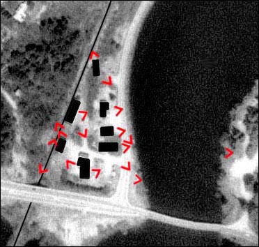
Lewiston as it looks today. This map locates the 1994 photographs that also are listed in the menu below. Click on a red angle to see an image here (map modified from detail of 1992 aerial photograph of Hanover from Microsoft's Terraserver).
|
|
Lewiston as it looks today. This map locates the 1994 photographs that also are listed in the menu below. Click on a red angle to see an image here (map modified from detail of 1992 aerial photograph of Hanover from Microsoft's Terraserver).
|