The megastructure of the Hopkins Center for the Arts forms the largest part of a zone that an essay on this site called Hopland or possibly SoWhee; lately the college has been calling this area the Arts District.
A project to renovate and expand the Hop has been the works for years. After a thorough arts master plan by Rogers Marvell and a thoughtful Hop expansion design by Bora Architecture, the college recently invited 15 firms submit designs; among the respondents it selected three finalists and eventually chose the New York office of Snøhetta. That firm finished schematics in the fall of 2021, and in January of 2022 the trustees approved funds to complete the designs.
The college unveiled the new designs on Thursday (see the college announcement, which includes a page devoted to the renderings, a page on some of the new spaces, and a FAQ page; the Snøhetta press release; the Valley News article; and the Archpaper article).
The announcement features five images of the Snøhetta design by the Argentine firm Methanoia:
-
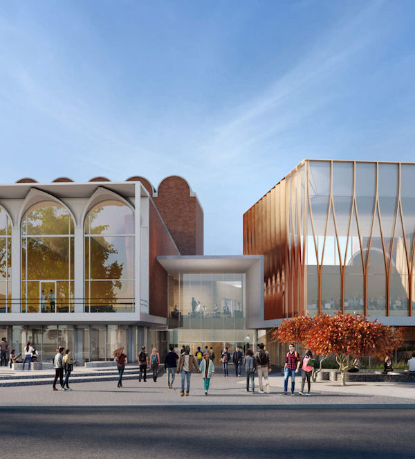
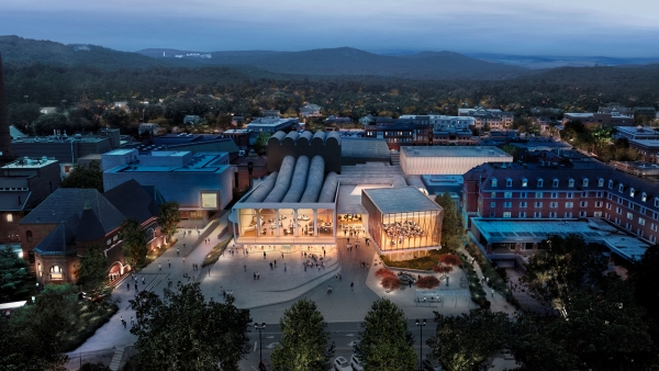
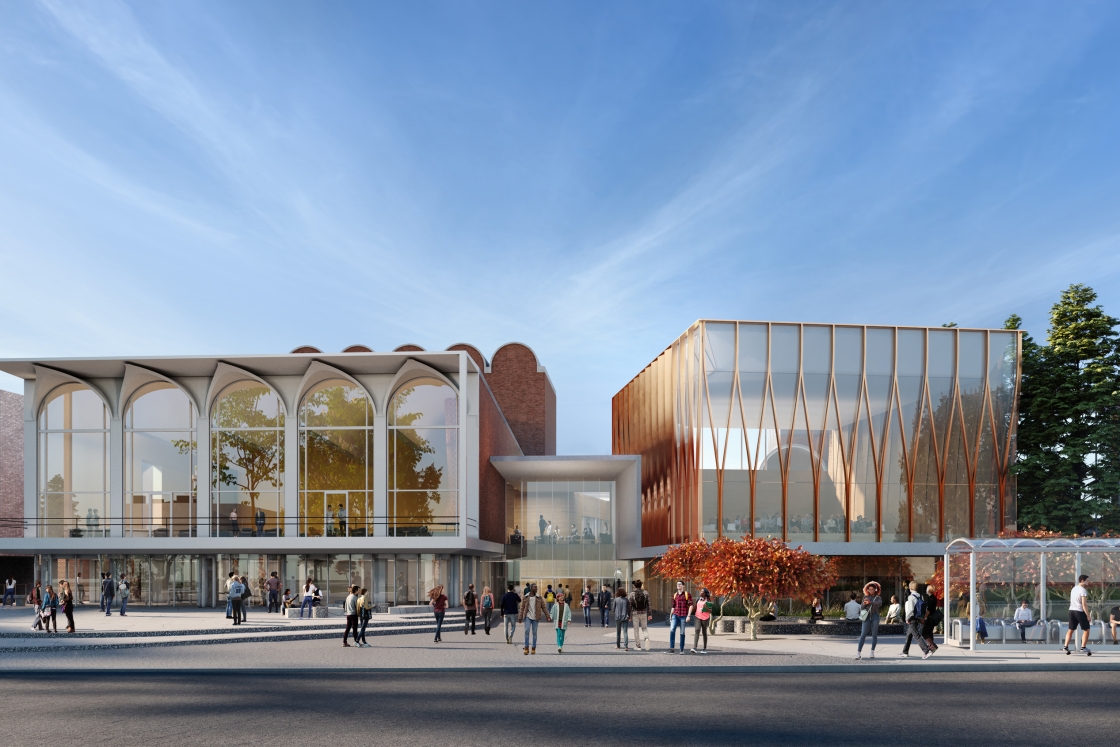
An oblique aerial view to the south, which gives the best idea of how the front additions relate to the existing complex;
-
A view to the south, which shows the north facade additions. This image from Google Street View is an equivalent view of current conditions;
-
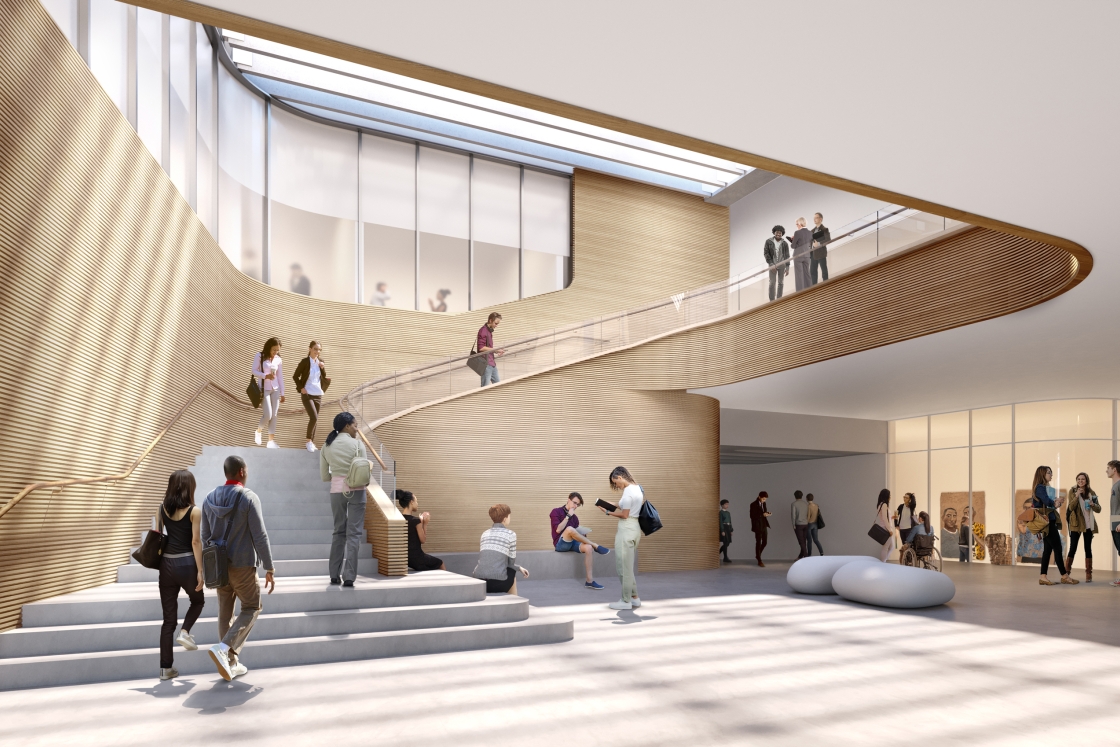
An interior view to the south, which shows the new main entrance lobby with its stair leading up to the recital hall and the Top of the Hop. The site of this stair is currently a small courtyard. What seems to be a vestige of the existing Strauss Gallery is visible off to the right;
-
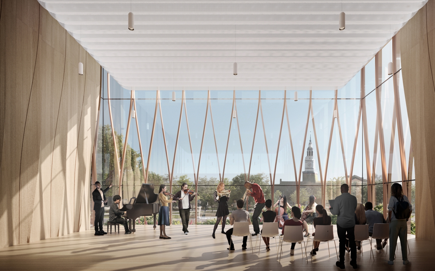
An interior view of the recital hall facing north; and
-
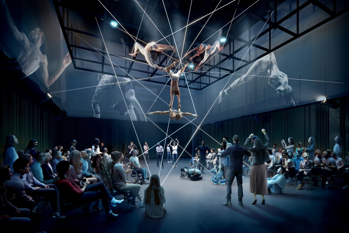
A somewhat generic interior view of the performance lab, which shows the renovated and raised Alumni Hall.
 Detail of front facade rendering showing new main entrance.
The projecting front addition
The Snøhetta design, while focusing on some of the same inflection points as Bora’s design, takes the more radical step of setting up a new projecting addition off the front of the Hopkins Center complex. Although the basic idea of a projecting addition is not new (this post here showed such an addition in a master plan about 15 years ago), the adoption of an arbitrary non-axial orientation for this box is novel and important.
The new recital hall comes off Alumni Hall to the northwest at an angle that looks to be somewhat steeper than the angle by which Wilson projects off the complex to the northeast. The adoption of an angled alignment for the recital hall does a lot to break up rectilinear monotony of the block.
Although the recital hall will occupy the Zahm Garden site, “[a] fountain and war memorial now located in Zahm will be moved to other campus locations” The recital hall does not disturb the Minary addition to the Inn, although the rendering cruelly obscures Minary almost entirely behind a tree.
The recital hall is sheathed in glass at its front and rear and apparently is blind-walled wood elsewhere; the entire building is is decorated by a triangular-arched giant-scale tracery, also apparently made of wood. These somewhat-Gothic triangular arches form a counterpart to the Moore Theatre’s round arches and its half-groin vaults and become the signature motif of Snøhetta’s set of interventions in the complex.
The creation of this western projecting counterpoint to the existing, iconic Moore Theatre on the east naturally implies a recessed joint between the two.
The main entrance
In Snøhetta’s design, the recessed joint between the new recital hall and the existing theater forms a new central entrance for the Hop. This makes a great deal of sense and, again, was advocated for in an essay here years ago. Even if students keep on using their shortcuts (or snowcuts) by entering the complex through Moore or Minary, this new entrance will provide clarity for the visitor and will allow the Moore Theatre finally to take on its own identity.
The images do not show any signage, but it would make sense to place the words HOPKINS CENTER in large letters above this new central entrance. We do know that at the Moore Theatre, “[t]he outdoor marquee sign will be reimagined as planners consider new opportunities to share programing information through multimedia signage.”
Alumni Hall
Alumni Hall will be retained but its roof will be “raised” — demolished and replaced, surely — to allow the space to become a performance laboratory. “Alumni Award winners recognized on plaques in Alumni Hall will be recognized in Blunt Alumni Center.”
The large unremarked rear addition
Bora proposed a new theater addition for the Hop’s existing Hood-side courtyard (of Courtyard Café fame), but Snøhetta does not: “The Courtyard Café will remain in the redesigned Hop[.]” Instead, Snøhetta appears to site a large rear addition, described as containing “space for students,” in the vast parking lot that lies behind the Inn and along the buildings of South Main Street. This is a place that has been crying out for construction many decades, but the addition will also take with it a part of the existing Hop, the small east-west block containing the HBs. The college does seem to have devoted some attention to this:
Hinman boxes are no longer used by students, who have been raised on digital communications and often receive packages far too large to fit in a Hinman box. Because the boxes hold a special place in the hearts of generations of Dartmouth alumni, sections of the boxes will be kept and memorialized in the new building.
Conclusion
Judging from just the five renderings, the impressive design strives for a high-minded timelessness rather than subsuming itself entirely to Wallace Harrison’s vision or being content with tinkering at the margins. Now what we crave are floorplans.