Dorms on Lyme Road?

Dartmouth News and the Valley News report on the college’s interest in developing the land north of the Life Sciences Building, including parts of the golf course. The possibility of such development was spelled out in the master plan some time ago, but the noteworthy new detail is that the college is considering building dormitories on some part of the site.

First reaction to the dorm idea: This is an unserious proposal, a negotiating tactic, like the College Park dorm idea. It is a silly idea. The ten-minute walking radius from Baker is not just a guideline, it is a crucial rule of campus composition. Plans for transit do not eliminate the ten-minute walking radius, and it just does not seem appropriate to have students riding the school bus to class in a place as small as Hanover.

After a closer look: From Baker Library to the Dewey Field parking lot site might be a half-mile and take nine minutes to reach on foot, making it technically acceptable. It is about as far away as the River Cluster was — not an admirable standard, but a Dartmouth precedent. One hopes that the Dewey Field site is the only one they are talking about for a dorm, because any site beyond it would be unacceptable.

(What about the college-related buildings that are not part of the everyday life of students or faculty? Storage libraries and development offices and various back-office functions would be perfect for the golf course sites. They would be much better sited here than in the sprawl of Centerra or in towns around the region.)

If not on Lyme Road, where could the increasing number of students be housed? (The proposed Crosby Street dorm will be ignored, because it will be used as swing space to house students from existing clusters as they are renovated.) Here are some available sites, some of them identified in the current master plan:

  • A second Mass Row
  • The Gilman site (offered in the College Park dorm siting discussion)
  • The Maynard and Rope Ferry corner (or any site on any side of Maynard Yard)

Might it be the case that the number of additional students to be housed, say 350 students, would be too large to fit on one of those sites? Yes. That is a good thing, both for Hanover’s urbanism and for the students who end up living in the new hall. Instead of building a giant barracks, the school should add additional beds to the existing campus at a combination of smaller sites within the ten-minute walking radius, including:

  • Additions to and eventual replacement of the Choates
  • An addition to Wheeler Hall
  • A dormitory range on the outer edge of College Park between RipWoodSmith and Andres
  • A dormitory range west or north of McLane Hall

Obviously these new additions will have to join existing house communities; there is nothing wrong with that. Creating a subtle and sensitive series of additions to historic buildings will be more expensive than dropping a single giant complex on a distant lot, but it will be worth it. It seems that the desire to add beds to the campus exclusively in the form of one entirely new house community at a time is driving the push to build dorms outside of town, and it is harmful.

More observations about the final strategic master plan

The college released the final (November 2020) version of the master plan (pdf) in July of 2021 (Anna Merriman, “Dartmouth master plan calls for growth along Lyme Road,” Valley News (2 July 2021)). The plan is not getting enough press or enough praise, so here are some observations:

  • As noted earlier, the possibilities for growth in the central campus look great (page 38).

  • The north end opportunity sites are all super. Old Hospital Quad will be an incredible space 130 years in the making (pages 42-43). Fairchild Tower always did seem more than necessary for its purpose; it is really a signpost building (pages 44-45).

  • Putting student housing in Remsen-Vail might be touchy. If you wanted to reuse a dull Sixties building as housing, you should have done it with the DHMC tower. Remsen-Vail could be appropriately used for academic purposes, however (page 44).

  • Lyme Road development is inevitable, but it is not clear how realistic it is to show such development without parking lots (pages 46-47).

  • When it comes to the West End, the novelty in this plan is the meander of the Cemetery Bridge (Thayer Viaduct). It is more like a boardwalk on a nature trail and does not appear to be a suspension bridge at all — but won’t it be extremely difficult to put bridge footings in a cemetery? (Pages 48-49).

  • More on the West End: Again, the original Tuck School building here could make an amazing undergraduate dormitory, but one would hate to see Tuck School vanish into the suburbs (pages 48-49).

  • South End and Downtown: The athletics promenade between Lebanon St. and Thompson Arena is excellent and long overdue. It could be a fine linear work of landscape architecture. Annexing Davis Varsity House as a part of the “house community” for the Crosby Street swing space dorm could be a superb move. The reasoning behind the focus on wellness for an expanded McKenzie is not clear — couldn’t it be used for anything, including arts uses? — but it makes no difference as long as the building is saved. McKenzie might present a real opportunity to create a new building within the historic brick walls (pages 52-53).

  • Quibbles are minor and basically the same as before: Thayer School didn’t go from the old Experiment Station directly to the West End in 1939, it spent several years in Bissell Gymnasium (page 9); the reference to “Dart Hall” is kind of irritating (page 38); and it’s “Bema” not BEMA (page 41).

  • The map on pages 28 and 29 showing named landscape opportunities is an important document. Some offhand proposals for these spaces:

    Name in Plan Proposed Replacement
    Riverfront Park Leydard Park
    West End Green A tough one; this was the Wigwam Circle postwar housing area.
    Tuck Green at the end of Tuck Mall Tuck Circle
    Dart Row Commons Fayer Green? “Commons” is not really appropriate for an open space.
    Maynard Yard Old Hospital Yard. This really is a better name.
    Life Sciences Lawn Another tough one; there is very little historic context here.
    North End Green in a strip of Dewey Field Dewey Field. Another one that really is a better name.
    Vox Lane NHCAMA; New Hampshire something; or State College something? “Vox Lane” has always been arbitrary, which is disappointing in this richly historic precinct.
    Park Street Gateway Piazza Nervi. This is tougher to justify now that grass rather than hardscape is proposed for this space.

Various topics including two West End flythroughs

Various topics, including unbuilt buildings

  • An article in The Dartmouth notes the completion of work on Reed and Baker and the start of work on Dartmouth Hall.

  • The HGA [architects] page for the CECS building has an image showing main entrance with the name KEMENY HARDENBERG above the door.

  • The Goody Clancy page on the Irving Institute is up.

  • What might have been: The central and right-hand groups of images on Samer Afifi’s site show (1) a more traditionally-massed CECS on the site where it is now being built and (2) a very unfortunately sited Irving Institute way back on the River Cluster site — not only distant from any important campus axis but also blocking any further Tuck School expansion.

  • This has been noted here before, but it is always fun to see: A Kliment/Halsband-designed addition to the Shower Towers to house Sudikoff. It looks perfectly pleasant, but it must have been overtaken by VSBA planning for Berry Row.

  • Kellogg Auditorium, perhaps the only building at Dartmouth named for a room, has been renamed Kellogg Hall and renovated as a classroom building. It opened last fall (Susan Green, “Newly Renovated and Renamed Kellogg Hall Opens” (29 September 2020)).

  • Dartmouth News has a piece on the importance of the DHMC parking lot as a social space in pandemic times.

  • Many outlets, including the Concord Monitor, have written about the huge college-affiliated apartment complex that will be built on Route 120 at Mt. Support Road.

  • The Davison Block, a prominent and historic commercial building at the top of Main Street in downtown Hanover, has been sold by the Davison family, reports the Valley News.

  • The Valley News also had an article on a sort of Christkindlmarkt that was set up in Hanover over the holidays. Fantastic. So many nice touches could be added to downtown, especially on South Main Street above Lebanon Street, whether by raising the street level (happening?), adding bollards, or limiting traffic and parking. An inviting town square could be delineated in front of the Municipal Building.

  • The Valley News reports on the college’s pullback from the idea of a new biomass heating plant. This is probably good news for the preservation of the old smokestack.

  • There are some great photos in the annual roundup of shots by Dartmouth photographers. The aerial of Baker Lawn does look like a De Stijl painting, as noted. It might look even more like a work in batik, an impression created by the imperfections in the edges of the paths and the snow-covered roofs.

Hilton Field as a sculpture park

Here is a thought: What if, instead of calling for an arboretum on the former golf course, the master plan (see the post here) proposed to construct a large sculpture park? A sculpture park on Hilton Field, the part of the golf course that lies north of Occom Pond, would have little more impact on the neighbors than would an arboretum. It would be managed by the Hood Museum as a site for major new works, and it could provide a home for any refugee works that the college thought appropriate to move from the campus, such as Thel (see the article here; the master plan at least hints at the possible removal of Thel).

Speaking of Thel, here is William Blake’s new gravestone in Bunhill Fields Burial Ground in London. It was created by the Blake Society under the leadership of Philip Pullman, of His Dark Materials fame.

Photo of grave of William Blake in London by Scott Meacham

The Anonymous Hall bridge (see photos at the Windover Construction site) deserves praise for adding to the walkability of the northern part of the campus. It seems like the sort of amenity that could easily be cut from a construction budget.

Let’s hope the proposed cemetery bridge (see the final image at the BBB master plan project page for a conceptual view) eventually is built, and when it does cross the burial ground, let’s hope it receives an appropriate amount of design attention. What a fantastic project this could be, and what a great opportunity for an architectural commentary on the influence of ancient Egypt on both bridges and funerary architecture. See for example the post here for a proposal to erect an ominous cemetery gate at each end of the bridge.

Egyptian Revival architecture makes for a good folly; authors Gwyn Headley and Wim Meulenkamp have a new book out called The English Folly: The Edifice Complex. Their earlier book, Follies: A Guide to Rogue Architecture in England, Scotland and Wales, features a photo of the Dunmore Pineapple in Scotland (Wikipedia) on its cover. Yes, that Dunmore: the building’s patron, John Murray, was the Governor of Virginia at the beginning of the Revolution. On December 6, 1775, Murray wrote to (that) Lord Dartmouth to say that “I immediately ordered a Fort to be erected” at Great Bridge, on the edge of the Great Dismal Swamp (pdf, 1311). The utilitarian and hastily-built timber stockade called Fort Murray was pretty much the opposite of a folly; it withstood a rebel siege but no longer exists.

The master plan: initial impressions

See the latest version of Planning for Possibilities on the Presentations and Outcomes page. So far, the October 2020 draft plan and a slide deck have been posted.

The new master plan is very impressive.

The scope of the plan is impressive. It is the first master plan for the college to at least account for all college properties (the map on page 5 is zoomed out so far that it shows part of Canada) and the first plan to frame the campus in a regional context. Especially where transit is concerned, the Organic Farm and DHMC really do need to appear on the same map.

The document is more readable and less technical than its predecessors. Its creators made the interesting decision to use oblique aerial views exclusively — meaning that none of the proposals for development appear as flat “plans.”

The potential projects on campus look excellent. Placing a building on the lawn of Shabazz Hall makes so much sense. The natural site for a new physical sciences building beyond Burke of course requires yet another demolition of Dragon. The proposals for Bartlett and Wheeler additions are fantastic, with the latter being particularly bold. The natural row behind Mass Row could incorporate an abutment of, or at least an entry plaza for, the Cemetery Bridge at its south end. The Bema pavilion makes sense (maybe the place will see more use if it has a proper covered stage?), though erecting a frame building would be unusual in that space.

One might wish the planners had considered building on the vacant lots in front of Sanborn and south of Blunt as well. And why not show a building site on Berry Row between Kemeny and Moore? It has always been planned that way, even going back to VSBA days after the purchase of the hospital property. Oh well. (The plan also does not clearly note the anticipated Ledyard Canoe Club replacement, but that is not important.)

Here’s hoping that the college preserves the old frame buildings that are now standing on the various development sites. There are two buildings on the site behind Mass Row, two on the Choate Road corner, two in front of Thompson, and two on College Street next to Sudikoff. There is also a certain amount of appeal to the idea of saving Sudikoff itself, the village-like assemblage of brick house-forms, and of saving Raven, but neither building is of a scale to stand up to Moore Hall next door. Clearing the Sudikoff corner is the breaking of eggs to make an omelet in this plan.

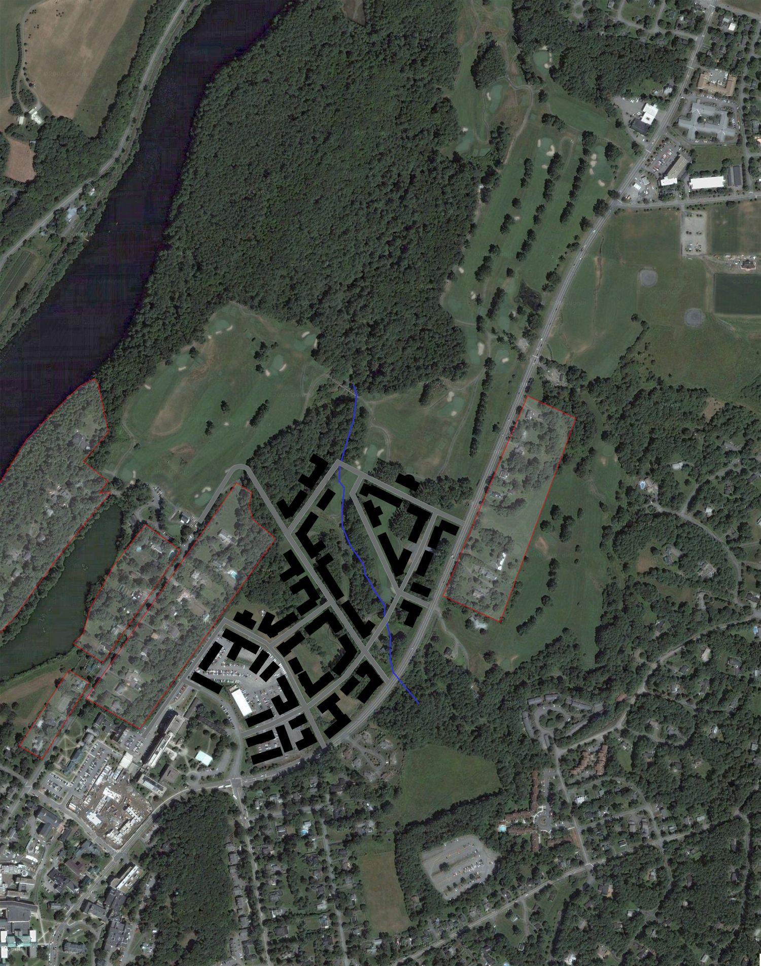
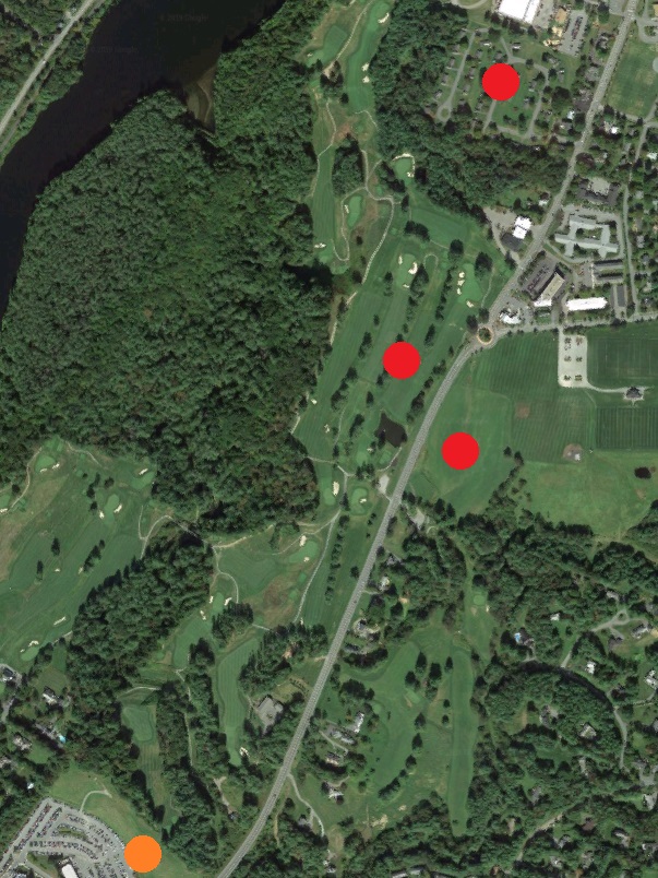
The big question: Hilton Field (the western portion of the golf course)

The plan proposes that the oldest portion of the shuttered golf course be turned into an arboretum. This is a clever choice, especially given the neighborhood and its sensitivities. An arboretum really is typologically and functionally similar to a golf course or, for that matter, a city park or a cemetery. In the end, this minor change in use might amount to nothing more than ceding the land to nature as at the adjacent (and intermingled!) Pine Park. And yet an arboretum will not take Hilton Field off the table for some distant future development if it is needed. Still, the college would probably be remiss not to put a half-dozen houses for sale to faculty along Hilton Field Road at the same time it lays out the arboretum. What an opportunity!

East and North of the Green

The Thel sculpture is not mentioned, but it might be endangered:

Fairchild Field
A new shared surface for cars, pedestrians, and bikes, in lieu of a vehicular access road, creates better pedestrian connections between the Physical Sciences Complex and the Historic Core.

Anything that replaces the access road would be an improvement.

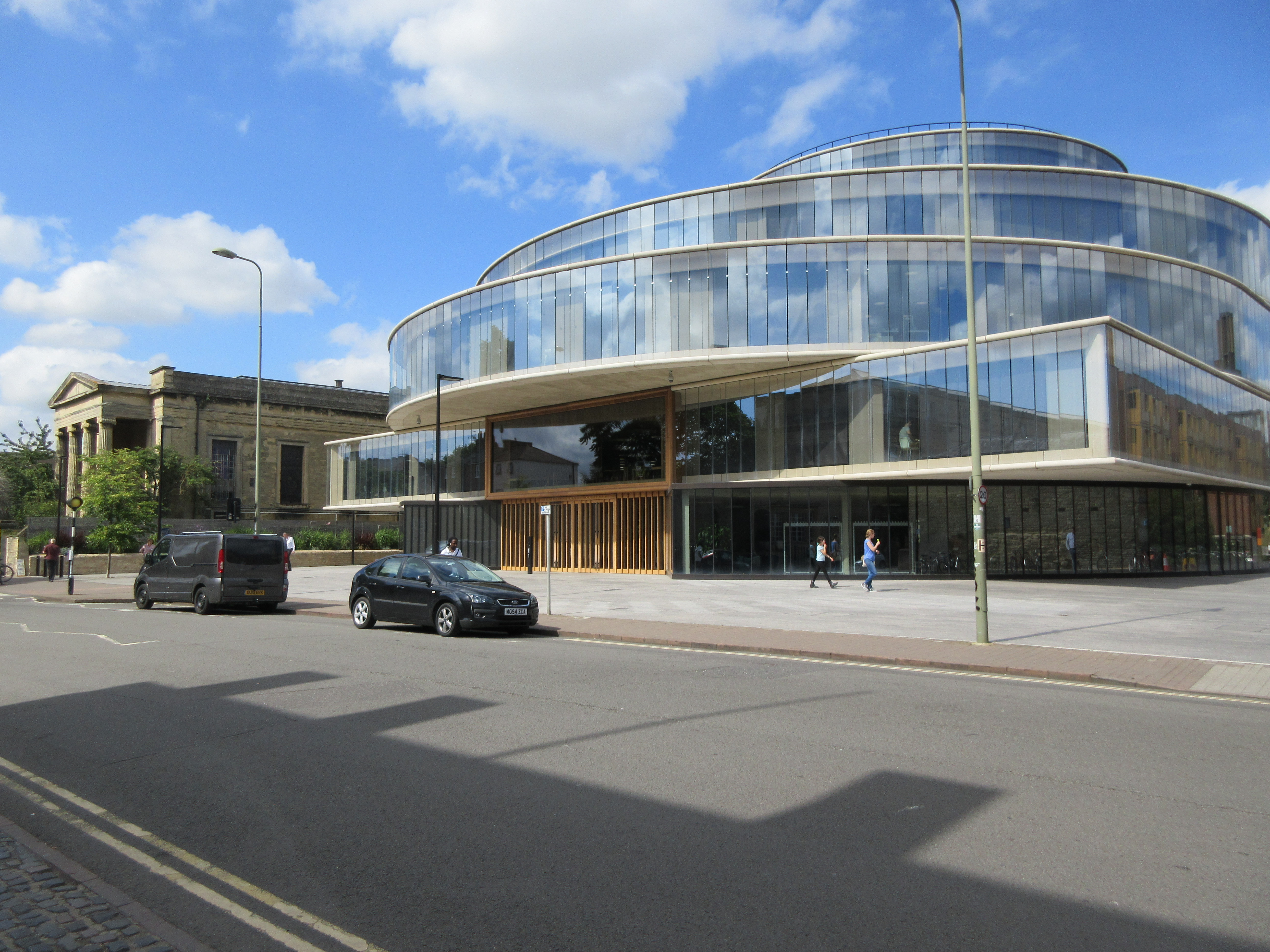
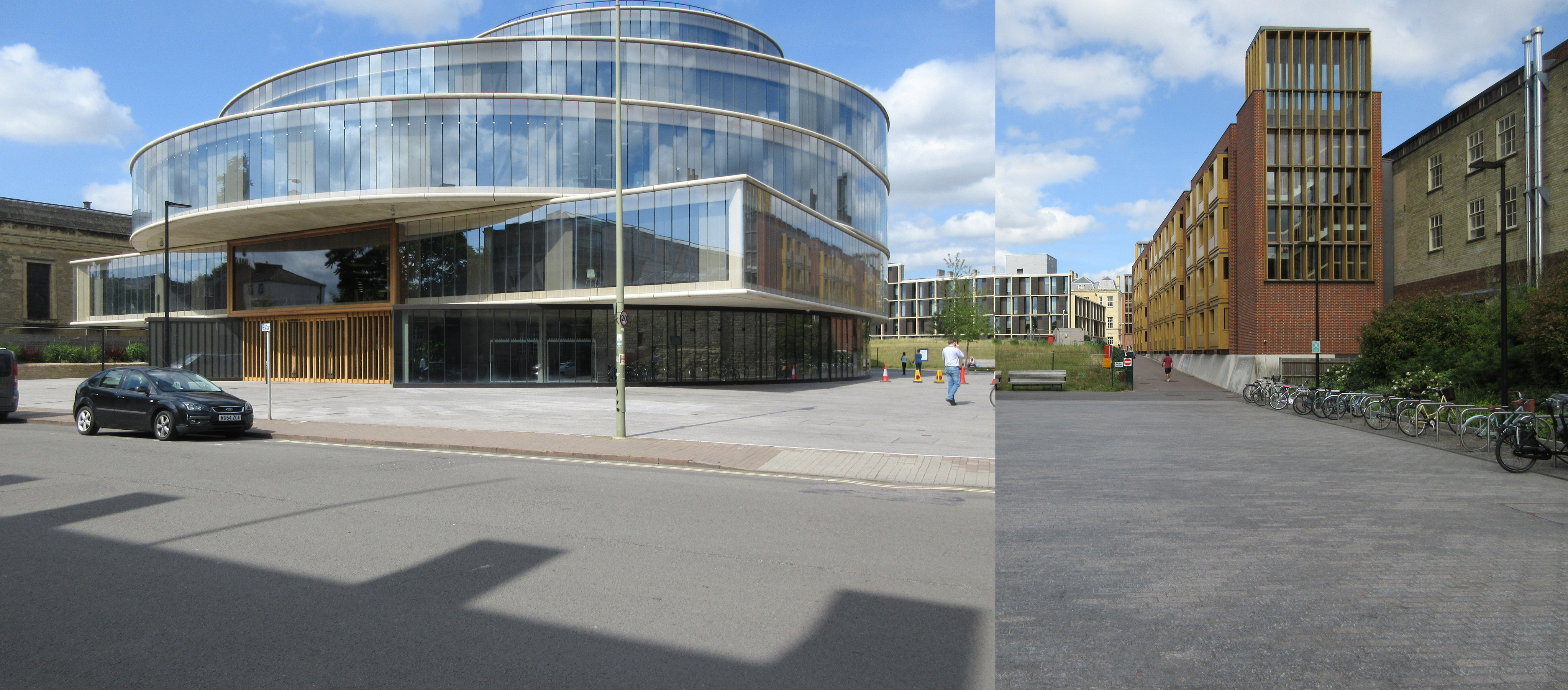
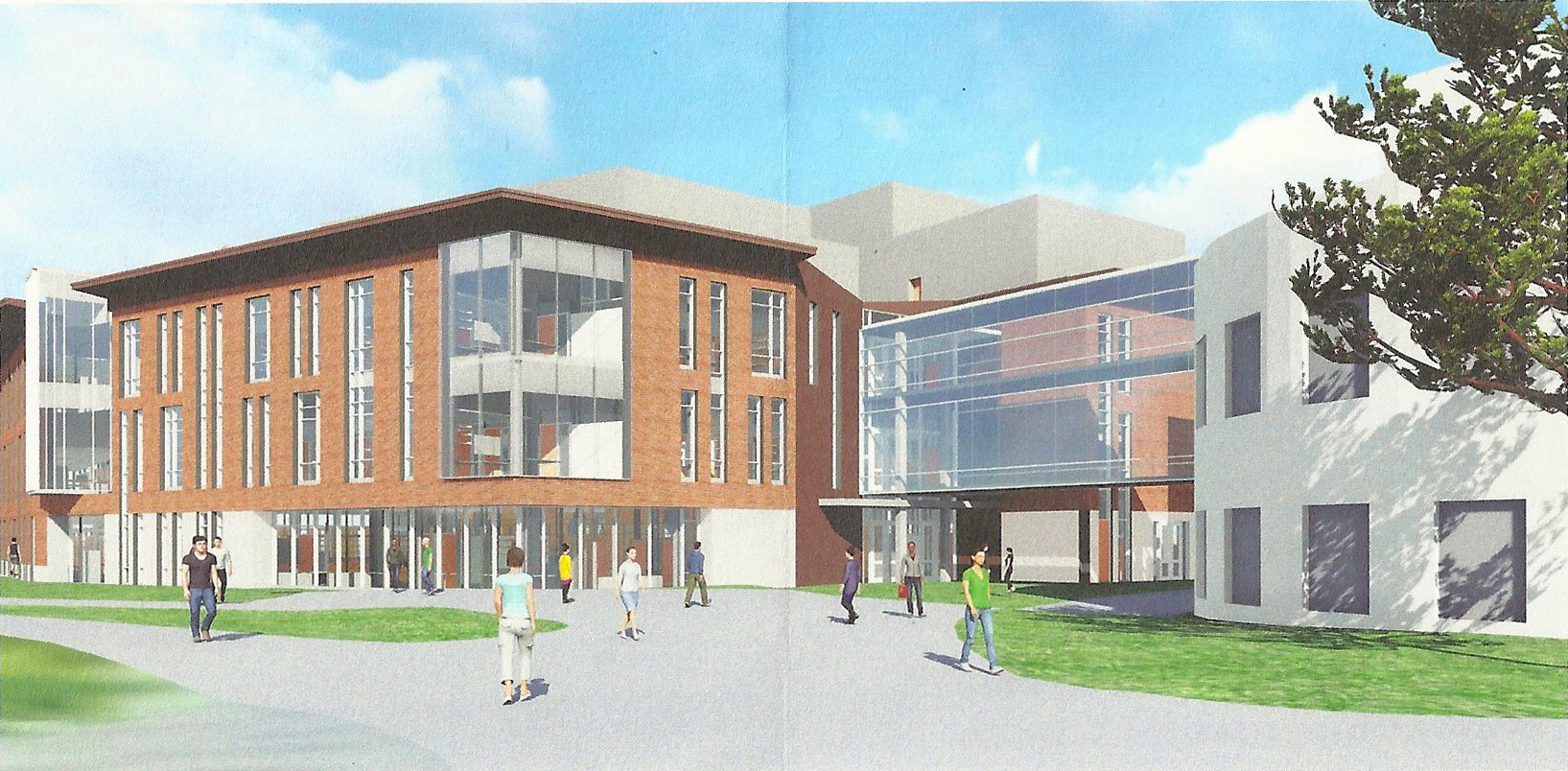
The plan devotes a great deal of attention to Fairchild Tower. It proposes a new interior stair and a bridge (to Wilder, presumably). Fairchild has always seemed a chilly, hollow signpost, but the illustrations in the plan remind us of how stylish it is.

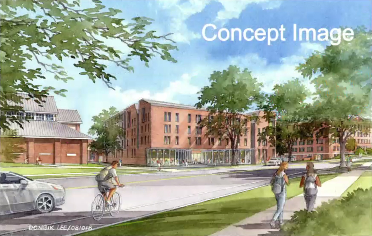
Moving south across Wheelock Street, the big Vox Lane redevelopment image shows McKenzie and the Store House as not only preserved but expanded vertically into a “wellness” building — fantastic. That will be one of the most architecturally interesting buildings on campus. (This proposal was not included in an August presentation image and thus seems to be a recent inspiration.)

South of the Store House is shown a parking garage on the FO&M corner. Fine, but one hopes that it will have retail uses on the ground level. It could make for a neat visitor entry to campus: you drive to town, park in the garage, follow the signs to the back door of Wilson Hall — the new admissions office, in this plan — and when you embark on your campus tour and pass through Wilson’s great arch you see the Green laid out before you.

It is good to see the athletics promenade alongside Leverone (page 52). And Piazza Nervi is on the map, described this way:

Park St Gateway
A gracious gateway to athletics and the campus visually connects the Leverone Fieldhouse and Thompson Arena, both historic modernist structures designed by Pier Luigi Nervi.

That “gateway” project would move the two houses currently blocking the view of Thompson Arena and, interestingly, would add a roadway in front of Thompson. Clever: lining a lawn with streets sets it off as a public space, a public green.

North Campus

The architects’ image of a Maynard Street Green on page 45 looks like a Currier and Ives print.

The plan mentions the possibility of moving all existing uses out of the Rope Ferry Road buildings and turning the buildings into graduate dorms. Interesting! But wait, do they mean vacating Dick’s House too? They do, apparently — which would be too bad. Would there be any infirmary on campus, or have student health services become a collection of vending machines? Presumably the infirmary would go to the “wellness” building at McKenzie. If that is what it takes to save McKenzie, then so be it.

And beyond: Land banks on Lyme Road

The new buildings north of the Class of 1978 Life Sciences Center are a great start, and there could be many more here. Dewey Lot has so much space, as stated in the report, and so much potential. The depression here creates a fantastic opportunity for an extensive below-grade parking deck. As stated on this site in the past, however, the functions placed here should not be college-related. This is no more a part of the campus than is the CVS (Grand Union) building, and college ownership of this site does not change that fact.

Moving up along Lyme Road outside of town: The two alternative land bank locations labeled “Site 1” will inevitably be suburban and oriented to Lyme Road, notwithstanding the plan’s idealism about self-driving cars. They really will have parking lots, because they will become office parks and convenience stores. As far as the choice between near and far, the farther site, next to the fire station, seems preferable. There is less chance that it will contain anything that undergraduates would need to visit.

More on the two locations of Geisel, the Grand Limited-Access Road, and the rest of the plan in a future post.

The College Street sidewalk and other topics

  • The college is replacing some of the glass curtain walls on the Black Family Visual Arts Center, including the large etched glass window that clad the upper levels of the building over the west (campus) entrance (former link). The replacement glass here and over the south entrance will be less distracting and provide better management of daylight. The etched design over the west entrance, however lovely up close, did always look from a distance like creeping frost or condensation inside a multipane window whose seal had failed.

  • Very interesting: the college is putting a lot of effort into installing a sidewalk along College Street north of the site of the old DG House (see North College Street Sidewalk weekly update). Sidewalks are good, and this one must have been deemed necessary, but there was something romantic about the way College Park spilled wildly toward the shoulder of the road, untamed. Just look at this barely-trammeled wilderness, as seen in Google Street View during July 2019:

    At any rate, the project involves what appears to be a hand-laid stone retaining wall intended as a counterpart to the existing wall to the south. (Does that existing wall incorporate foundation stones from the Victorian DG House?)

  • Dartmouth News has a video on the wooden sculpture by Ursula von Rydingsvard called Wide Babelki Bowl that now stands northwest of Rollins Chapel. (It is not really a southern counterpart to Thel; that honor was held by Telemark Shortline, which has been removed.) As Jessica Hong notes in the video, the sculpture has a definite kinship with the cyclopean masonry of Rollins; it is also reminiscent of the multi-stone sculptures of Angkor Wat.

  • The college is going ahead with the DOC House renovation (project page) with funding from the Class of 1969. Compare the project page image with the image at The Call to Lead to see the exterior changes on the Occom Pond facade.

  • It is not clear if there is an earlier public mention than this April 20 article, but the trim Sports Pavilion by Burnham Field that was built in 2007 and expanded a decade later has finally been given a name: Reilly Pavilion.

  • Housing developer Michaels Student Living will build an $84 million graduate student housing complex on Mt. Support Road, near the hospital, in coordination with the college (see renderings in Dartmouth News release, site plan in The Dartmouth). The designer is JSA Design of Portsmouth (Boston Real Estate Times).

  • The Valley News reports that plans are afoot to save the Hanover Country Club as a nine-hole course. The northern two-thirds of the course, comprising holes seven through 15, would be used in the new course; the southern portion of the course, lying south of the bulk of Pine Park and including the clubhouse area and the bridge over Girl Brook, would be made available for possible college expansion.

  • The Valley News has a story on a new cold chamber to be built at CRREL.

  • The steel frame of the Irving Institute has been topped off (Dartmouth News).

  • Most construction projects, including the construction of a large dormitory at the corner of Crosby and Wheelock Streets, are on hold, reported The Dartmouth in June.

  • Vermonter Putnam Blodgett ’53 died on March 20 (Valley News). He led the Moosilauke advisory committee, and his woods were the source of the unique forked white pine called Slingshot that supports the second-level bridge as well as the roof of the new Ravine Lodge (see photos in Jim Collins, Welcome to the Woods, DAM (Jan-Feb 2018)). I recall him at the 1995 Senior Symposium talking about the 1949 Tug of War: apparently the regular tug of war between the freshmen and the seniors had come to be seen as too large and dangerous, so the college placed a huge log between the opposing teams and attached multiple ropes to each side. Unfortunately, one of the ropes came loose and the log went flying in the opposite direction, toward the side with more pulling force. He said it was a miracle that no one was badly injured.

  • A ring bearing the letter “Z” featured prominently in a photo in the July 24 Washington Post story on the Pebble Mine project in Alaska. The photograph, by Alex Milan Tracy, showed the right hand of then-CEO Tom Collier, a U.Va. graduate. It’s a safe bet that the ring indicates membership in the Z Society (Wikipedia).

The end of the Hanover Country Club

Along with ending five varsity sports, the college is closing the Hanover Country Club after nearly 125 years (see the announcement, which features another great Burakian aerial; see also the more detailed Hanlon message and the FAQ).

The golf course has been thought of as a land bank, a reserve for future development, for decades. A thorough college planning process can be expected before anything is built on the golf course.

Here are some suggestions for the plan:

  1. The historic clubhouse, a 19th-century barn that was extensively remodeled by Professor Homer Eaton Keyes in 1916 and 1917 (a post here), should be preserved, ideally on its current site. It could be expanded and turned into a dwelling.

    Hanover Country Club House, Dartmouth College
  2. If the golf course is going to be developed, it should be developed thoroughly. Piecemeal scatterings of parking lots and isolated buildings will only draw suburban sprawl closer to Hanover (a concern expressed in a 2008 post here). The college should plan for an all-encompassing, long-term project that reserves important natural areas, establishes a street grid, and envisions buildings surrounding walkable public spaces.
  3. More to the point, the development should be urban, not campus-like. The golf course lies outside the 10-minute walking radius of the college, and none of the buildings built there should contain spaces for instruction or student dining or living. These should be mixed-use commercial buildings like the ones found in Hanover’s first downtown, South Main Street. That is the idea presented in a 2012 post here that featured this image:

    north block proposal
  4. One exception to the no-campus guideline might be made for a new business school campus. Professional schools are located at the edges of the college, and the Tuck School has looked in the past at new sites along Lyme Road — which is too far away. A new Tuck campus beginning behind the Life Sciences Center and extending up into the golf course could be impressive. Thayer School might be happy to take over the old Tuck buildings.
  5. While commercial buildings extend northward along Lyme Road, what kind of construction should the college promote on old Hilton Field, the area beyond the DOC House and the Clubhouse? To bring some income, provide needed housing for academic families, and appease the existing neighbors, the college might want to consider building houses here in the character of the historic neighborhood.

Another report from the Radcliffe Observatory Quarter, five years on

During 2014 this site noted the progress that Oxford University was making in its redevelopment of a large former hospital site in the north end of town. At the time, the site of the Blavatnik School of Government was a hole in the ground:


The building has since been finished:


The site before:


After:


As noted, the circle-in-a-square building has a remarkable precedent at Oxford, the Radcliffe Camera (indeed, the Camera is such a symbol of the university that the Blavatnik School uses the Camera rather than its own building as the main image on its website).
The former St. Paul’s Church at left is the Freud Cafe and Bar. It appears much as it did in 1994, albeit more overgrown (see also the 2014 post on chapels as libraries).

College floats three sites for the new heating plant

First, the most important news: The college “will be decommissioning the current power plant, removing the stack and repurposing the building” (Planning Board Meeting Minutes 5 February 2019 pdf). That is reassuring. Naturally one would love to see the landmark 1958 stack retained as well and repurposed as a memorial column or a pedestal for public art, but we will take what we can get.

At a public meeting last month, the college revealed the three places that are in the running to become the site of the replacement heating plant (Valley News 22 May, Dartmouth News, The Dartmouth). The sites are:

1. The hill behind the Dewey parking lot, east of Rope Ferry Road and Occom Pond. This would not be the first power plant in the neighborhood, of course: the MHMH plant had a tall smokestack and stood in the parking lot behind 5 Rope Ferry Road (roughly behind the red BMW in this photo from Google Street View):

2. A site along Lyme Road by the Hanover Country Club’s maintenance facility garage at the south end of the golf course. This is the best we can do on Street View:

3. The third location is the former home of Trumbull-Nelson Construction Co., next to the Hanover Public Works Department, on Route 120.

The third option is the most distant and seems to be the only one that would not require trucks full of wood chips to drive through the center of town several times a day. That site would require a lengthy insulated underground pipeline to link up with the existing steam tunnel and pipe network, however. The pipeline can be no more than two miles long if it is to be efficient (Planning Board pdf). According to the map above, the route to the T-N site is about 1.6 miles, following roadways.

Because of its distance from campus and the possibility that it would keep some trucks out of town, the favorite site among the public seems to be the T-N site (Valley News 23 May).

Various construction topics

  • An Architectural Digest story on the Hood by Elizabeth Fazzare again refers to a gray brick supposedly used in the original building, this time stating that it was used in the iconic trabeated gateway. The gateway was made of concrete, however; Moore originally intended it to be of granite.
  • The Indoor Practice Facility weekly update includes an aerial image showing the building’s footprint.
  • Van Zelm Engineers, a firm that worked on the 1978 Life Sciences Center and has built some very interesting heating plants over the years, are working on the Irving Institute. Their project page shows a basic footprint for the Institute for the first time: it really is a screen building. The college project page now includes renderings of the side facades and a new interior view.
  • A flythrough video of the Thayer/CS building by Wilson Architects suggests that the complex will have quite a retaining wall on the west side; one hopes it’s made into “engineering” or at least faced in granite.
  • The Thayer School Parking Garage project page has some cute computer images of various stages of future excavation. Turner Construction has a camera on MacLean showing the construction site.
  • Campus Services reports on a project to remove diseased trees from Pine Park.
  • High-Profile and North Branch Construction have information on the renovation of Blunt into an academic building.
  • The Dana renovation remains an interesting project. There is a video flythrough at the Leers Weinzapfel Associates site, and it shows a little pedestrian bridge on the west side of the building. A glimpse of the building’s lobby shows the Guarini shield on an office door and a “graduate lounge” occupying a part of the building, possibly a holdover from the similarly-named space called for in the giant unbuilt dining commons that MRY and Bruner/Cott proposed for a site a few yards to the southwest. The glassy Dana frontispiece will be topped with a patio; the penthouse has a flat canopy roof that is covered in solar panels and almost gives the building the air of a pagoda.
  • Some Tuck Drive details from the July 3 minutes of the Planning Board (pdf):

    The road is about half a mile long. He stated they will be working within the existing asphalt and drainage swales in order to maintain the existing stone walls. Lighting along the road will be minimal. Fixtures will be spaced 80-120 feet apart. Better access to the loading dock at Murdough will be provided. From Wheelock Street, Old Tuck Drive will be a two way street and give access to the Ledyard Parking Lot. After the turn off to the parking lot, the drive becomes a one way access. There is a pedestrian crossing point marked by a raised speed table. Guardrails will be installed along Old Tuck Drive. There is a bike lane separated from vehicle traffic by a double yellow line. Close to Tuck Drive there will be sidewalks on both sides of the drive.

    […]

    Mr. Scherding stated the campus was open with busy streets and students were used to crossing streets and sharing roads. He stated the Director of Public Works suggested narrowing the road at pedestrian crossings to make it safer. Mr. Scherding said they talked about having a physical barrier between the vehicles and the bike lanes but currently it is not on the plans. ESMAY asked what the guardrail would look like. Mr. Scherding stated it would look like the existing granite bollards.

  • A report of the September trustees’ meeting describes a renovation project in which “the College intends to improve learning spaces throughout Dartmouth Hall to ensure that the building can meet the needs of faculty and students in the 21st century. As part of the planned construction, the College will restore some of the structure’s historic elements, overhaul the building’s systems, and upgrade its energy efficiency.”
  • Revision Energy has a page on its solar installations at the college. Some of the dormitory installations really do transform the appearance of the buildings.
  • Bruner/Cott has a page on its renovation of Baker Tower. The interior graffiti appear to have been removed.
  • The automated parking system of the UK Architects addition to the rear of the Bridgman Building is drawing some attention (ACPark.com, Parking-Net.com).
  • There is more news on the off-campus (or edge-of-campus?) heating plant project (Dartmouth News, The Dartmouth). Although a nice spot for it would be the Dewey Field parking lot (orange), my money’s on a few Lyme Road sites, shown in red:

Speculative map of potential heating plant sites

West End work beginning

The Thayer School expansion involves a lot of changes to an entire district of the campus. Campus Services has information on the overall project.

The page describes the new Thayer School building:

The proposed building, to be located south of the Maclean Engineering Sciences Center, will be constructed over a new three-level parking garage. The garage will replace Cummings lot, and will significantly increase the number of parking spaces in this area. This project will also change the flow of traffic along West Wheelock Street and throughout the West End. Thayer Drive will close, and a new access road will be constructed specifically to provide access to the parking garage, and Thayer loading docks and the Channing Cox parking lot. Old Tuck Drive will be reconstructed and reopened to support one-way traffic heading from west to east. Improvements to the intersection of West Wheelock, West Street, and the new access road will also be made to improve access and safety of pedestrians, cyclists and drivers.

Dartmouth News has a story on the proposal for a new set of stoplights on West Wheelock Street at Thayer Drive (see also the Valley News).

We learn from the college news story that the Thayer School building “will be connected at ground level to the MacLean Engineering Sciences Center and Cummings Hall.” Presumably “at ground level” means aboveground as opposed to belowground, where the garage is. Because renderings show only a second-level bridge connecting the new building to MacLean; pedestrians will go under the bridge to follow the “Green to Blue” route. See this rendering reproduced from the latest Dartmouth Life print publication (showing the existing brick wall of MacLean in white on the right):

image of Thayer School addition from Dartmouth Life

Incidentally, the college’s project manager for the Beyer Blinder Belle West End Master Plan was planner Douwe Wieberdink; he’s now with BBB. And the landscape architects for the West End work are Michael Van Valkenburgh Associates: perhaps one can feel a bit better about the fate of historic Tuck Drive following its partial demolition.

The college presents the three dorm sites

The college has been giving presentations (Valley News article) on the potential sites for a proposed 350-bed dorm. An initial list of four sites was reduced to three when College Park was dropped as a site for even this smaller version of the dorm. The three remaining sites are the former site of Gilman, the current site of Dragon on College Street, and the current site of the tennis courts and the Onion on Crosby Street at East Wheelock.

The suggestion on this site that scattering a few smaller additions around campus would be preferable to erecting a single 350-bed dormitory was based on the assumption that such a large building could not comfortably be shoehorned into a site as small as that on Crosby Street. Considering the fact that the entire McLaughlin cluster only contains 341 beds and has a footprint that is much too large to fit next to Alumni Gym, this assumption does not seem unreasonable.

The reason the college gives for the 350-bed number is the desire to use this swing space dorm to house an entire “house community” at a time. Fair enough — that is what Princeton did when it built Scully and Bloomberg Halls, initially planning the buildings to house a rotating cast of residents of other residential colleges as their own buildings were being renovated.

Adhering to the 350-bed goal will require all of the proposed buildings at Dartmouth to stand four and five stories high, and the Crosby Street site will require a building that stands five-and-a-half stories high.

At any rate, Sasaki (presumably) created a site plan and a massing study for each site and had Boston-area designer Dongik Lee draw up two perspective views of each potential building. These are nicely done and show the same style of building in each location. They are introduced with the caveat that they are not actual building proposals but are for illustration only.

Gilman and to a lesser extent College Street make sense as sites for some future building, but they do seem the lesser of the three sites for a new dormitory. College Street in particular begs to be left as forest or to become a site for an addition to Burke, part of a unified science complex 120 years in the making. (And constructing a building on College Street would bump off the Dragon Hall for at least the third time).

The Crosby Street proposal, called “the Question Mark” because of its shape, seems the most popular among audience members. It is nearer to dining areas and has a site that is not more suitable for some other use.

The site has indeed long been reserved for residential use — the 1998 master plan (pdf p. 19) states that “[a]t five stories, two residences on this site could accommodate 200 beds. Social and study spaces could be added to serve Topliff and New Hampshire [H]alls, too.” Interestingly, the 2001 plan and its 2002 update (pdf p. 12) would allow only 160 beds here.

Mills dorm site presentation slide 24 concept image Crosby site

Concept image of Crosby Street dorm from EVP Rick Mills presentation 16 August 2018

A dormitory on Crosby Street could make nice companion to Topliff, which was the giant dorm of its own era. One hopes, however, that the building could be given a footprint that is large enough — and that extends far enough to the south — to reduce its height somewhat. The driveway to Alumni Gym could be realigned to the south, and Davis Varsity House could be moved to face Lebanon Street as part of Larson Square, giving the new dorm more space in which to spread out. And this is completely unrealistic, at least until a Southern Bypass is built, but wouldn’t it be nice if Crosby Street could be partially or completely closed to traffic? That would be one way to make more space.

College asking for input on siting the new dorms

The college is holding informational sessions in Filene to air some potential sites for a large, 350-bed dormitory cluster (Dartmouth News). “Following the three sessions, administrators will select a preferred site and begin the design and evaluation phase of work.”

There is no word on how many sites will be on the menu. According to the Valley News, “[t]he college has not said publicly what sites are being considered, but spokeswoman Diana Lawrence on Monday said they are all on campus and will be announced at the meetings” (Valley News). One would not have thought it necessary to state that all of the sites are on campus, but this is going to be a huge group of buildings, likely larger than the McLaughlin Cluster.

The need for many new beds is difficult to dispute, especially if the Choates and the River are to be replaced. But the programmatic case for putting all the beds on one site, as opposed to splitting them among four or five buildings or additions to existing dorms, has yet to be made. The college could be letting the goal of efficiency of construction management on a single site get in the way of good campus planning. And the misguided effort to keep everything together is also likely to encourage unnecessary demolition.

Here is a very rough alternative suggestion of a few of the potential sites for dormitories of a reasonable size (basemap pdf):

August 2018 sketch map of some potential dorm sites

Bicentennial stamp design credits, other topics

  • The Dana project page shows the renovation and addition totally redoing the skin of the building: compare the Street View. The entrance is being moved from one end of the north façade to the center of the south facade, where it will occupy a full-height, south-facing, and very warm-looking glass addition (see the Planning Board minutes pdf).

    The project will include “a pedestrian bridge spanning the sunken lawn on the west side of Dana. Parking will also be added to support approximately 60 new spaces, and will connect to the Maynard parking lot” according to the project page. The Planning Board minutes also mention a green space in the interior of the block: that seems to be the corridor that passes beneath the bridge. The parking lot seems to occupy the Gilman site.
  • The rowing training facility project page shows that the facility should definitely read as an addition.
  • The first-day-of-issue ceremony program for the 1969 Dartmouth College Case stamp has some detailed information about the stamp’s design:

    The design of the stamp was selected from four sketches submitted by John R. Scotford, Jr., graphic designer for Dartmouth College and an alumnus. The drawing of Webster was done by P.J. Conkwright of Princeton in 1954 from a painting by John Pope (1821-1881) which now hangs in Parkhurst Hall in Hanover. The building in the background is Dartmouth Hall, built in 1784. During Webster’s undergraduate days and at the time the Dartmouth College case was being argued before the Supreme Court, Dartmouth Hall housed the whole College – dormitory, classrooms, library, and chapel.

    The stamp was engraved by Edward P. Archer, who did the vignette, and Kenneth C. Wiram, who did the lettering. Both are on the staff of the Bureau of Printing and Engraving.

    The type styles used are Craw Modern for the words “Daniel Webster” and “6¢ U. S. Postage,” and Torino Italic for the words “The Dartmouth College Case.”

  • A Dartmouth News article announces that Studio Nexus of WRJ, designers of the Co-Op Food Store expansion, won an award for their design of the DALI Lab in the basement of Sudikoff. The lab will be moving to the new Thayer/CS building in a few years.
  • The college is renovating the Blunt Alumni Center for academic use, with design by Studio Nexus and construction by North Branch. The brick house that forms the front of Blunt was built ca. 1810 for Professor Zephania Swift Moore ’93 and was owned by Medical School professor Dr. Dixi Crosby DMS ’24 and his family for decades beginning around 1838. The college bought the house and in 1896 had Lamb & Rich remodel it and add a large frame dormitory ell at the rear. The entrance portico with its giant-scale columns is a typical Rich device. The dormitory addition was replaced by the current Modernist brick office addition (1980, Benjamin Thompson Associates). The current project will create a new entrance on the north side of Blunt, giving easier access to Silsby Hall across Tuck Mall:

  • The Valley News has an article about the new programming initiative of the Hanover Historical Society. A presentation on the history of the golf course was on tap.
  • The Valley News also has an article about the plans of the Friends of Hanover Crew to demolish their 1770s farmhouse on Lyme Road, seen here in Google Street View:

  • This is unfortunate and disappointing. On the one hand, the group was saddled with this house when it acquired the property near the river. On the other hand, it is hard not to ask whether the group has taken on some obligation to the history and preservation of this place. If the house cannot become a headquarters or clubhouse for the high school rowing club, could it be renovated and rented out as an income generator? Would someone be willing to move it? Would the college be able to rescue it and move it a few hundred yards down the road to the Organic Farm?

  • The Smith & Vansant site features some recent renovation projects, including Triangle House and a number of historic buildings used as faculty housing.
  • The Hood has a video about the ongoing construction work and an article about the brick used on the addition’s exterior.
  • DHMC opened the Jack Byrne Center for Palliative and Hospice Care at the end of last year (Here in Hanover, DHMC, Health Facilities Management). Architects E4H — Environments for Health have photos.

Details on the new road to the Thayer & CS building

The BBB West End Master Plan (super image from BBB site; see also the Campus Services project page, written by BBB) turns out to be more than a schematic design. The meandering suburban business-park road is going to be built:

Another change will be the removal of Engineering Drive, which runs from West Wheelock Street to the Cummings lot. A new roadway, called West Access Road, will be constructed to provide access to the parking garage and Thayer loading facility as well as limited access to the West End Circle. A now-closed portion of Old Tuck Drive, which originates just above the swim docks and the Ledyard parking lot, will be reopened and will connect the roadway to Tuck Mall, pending town approval.11. Susan J. Boutwell, “Integrating Engineering, Computer Science, Entrepreneurship,” Dartmouth News (28 March 2018).

The project page for the Thayer/CS building provides more detail: “Engineering Drive will close, and a new access road will be constructed specifically to provide access to the parking garage and Thayer loading docks. Old Tuck Drive will be restored and reopened to support one-way traffic heading from west to east.”

Maybe the site conditions (steep slopes, existing buildings) require the endearingly-named West Access Road to look the way it does. After all, Tuck Drive22. Please, let’s stop calling it Old Tuck Drive. The word “Old” seems to have been added to the name of Tuck Drive to distinguish the short branch of the road that was eliminated by Fahey-McLane. That was a dozen years ago. There is no need to keep using the word. is a curving, naturalistic auto road. Yet one hopes that the new road will respect urban principles by reinforcing campus spaces.

One also hopes that the West Access Road will be reconnected to Tuck Mall once construction of the building is completed: that would seem to be the reason for the two-level pedestrian bridge that will join the building to the McLean ESC.

From the Dartmouth News article: “Construction is expected to start early next year on a three-level underground parking and loading facility, which will sit below the four-floor education portion of the building.” In the map that accompanies the article, the entrance to that subterranean lair underground garage appears just off the southwest corner of the new building. Last fall, the project page included a view of the building’s south facade from which is taken this detail showing the intriguing, grottolike entrance:

References
1 1. Susan J. Boutwell, “Integrating Engineering, Computer Science, Entrepreneurship,” Dartmouth News (28 March 2018).
2 2. Please, let’s stop calling it Old Tuck Drive. The word “Old” seems to have been added to the name of Tuck Drive to distinguish the short branch of the road that was eliminated by Fahey-McLane. That was a dozen years ago. There is no need to keep using the word.

A tree tour of campus

  • Dartmouth News writes on the Gilman demolition and Dana renovation.

    Dana entrance

    Dana Library entrance

  • The bench at Lebanon and Crosby is a puzzling object; it was being examined by two people when the Bing StreetSide View car drove by.

  • The Valley News:

    Trustees also reviewed designs for a building to house the Arthur L. Irving Institute for Energy and Society, a new interdisciplinary initiative launched with an $80 million gift from the family behind Irving Oil.

    Lawrence declined to share the designs publicly, saying they were “highly preliminary.”

    Administrators in regulatory filings earlier this year discussed building a $73 million structure at the end of Tuck Mall, on the west end of campus.1 Rob Wolfe, “Dartmouth Readies Fundraising Push,” Valley News (19 September 2017).

  • Dartmouth News has a neat film on the Campus Arborist with footage taken by a drone flying up into the canopies of some of the grand trees on campus. There is a link to an interactive map of notable campus trees.

  • The monthly Enterprise magazine, a Valley News publication, has articles on the Trumbull-Nelson centennial and the Hanover Improvement Society.

  • One thing that a reader might want to learn after reading Alan Burdick’s interesting New Yorker article on watermelon snow is how watermelon snow actually tastes. It tastes like watermelon.

  • The county court has upheld the town’s rejection of the college’s proposal for an indoor practice facility or fieldhouse in the Sunken Garden (Valley News).

  • The new Moosilauke Ravine Lodge is opening October 14.

——————

References
1 Rob Wolfe, “Dartmouth Readies Fundraising Push,” Valley News (19 September 2017).

President for the time being

  • A task force is exploring the possibility of expanding college enrollment from about 4,310 to as many as 5,387 (press release, Inside Higher Ed). Maybe that’s why the Golf Course land is so appealing.

  • Freeman French Freeman has a rendering and a plan of the expansion of the Sports Pavilion out at Burnham Field (FFF brochure). The building is still not named after anyone. The rendering shows some lettering on the side of the building: DONOR PAVILION.

  • Morton Hall, a building in the East Wheelock Cluster, has opened again after it was damaged in a fire (press release). The building was gutted and a new interior was designed by Harriman Associates of Portland, Maine (Harriman).

  • The timber-framed picnic pavilion has opened at the Organic Farm (Dartmouth News).

  • An old railroad station in West Lebanon has been moved (Valley News).

  • Dana, once on the chopping block, is being renovated by Leers Weinzapfel Architects of Boston,
    authors of some great chiller plants and the huge UPenn athletic field complex of Penn Park (with MVVA).
    Dana is expected to be ready in the fall of 2019. Gilman will be demolished by the end of this year (Campus Services).

  • The Class of 1967 Bunkhouse has opened at Moosilauke.1 Tricia McKeon, “New Class of 1967 Bunkhouse Supports Dartmouth’s Spirit of Adventure,” Alumni News (19 July 2017).

  • The Rauner Blog has an article on the demolition of “Dartmouth College,” one of the original buildings of the school.

  • The Irving Institute building page notes that the 50-55,000 gsf building will connect to the Murdough Center through an atrium and will attempt to meet LEED platinum requirements.

  • Enjoy Michael Hinsley’s local history corner at DailyUV, Tragedies and Disasters.

  • There is some good insight in Callie Budrick’s article “Victorian Foppishness & Making the McSweeney’s Generation,” Print (11 August 2017) (via Things Magazine)

  • Project VetCare, which was not an animal hospital but a military veterans’ organization with laudable aims, is being shut down after apparent embezzlement (Valley News). The group had a house in Hanover that it intended as a residence for Dartmouth vets.

  • There are some nice photos of the fireplace masonry at the construction updates page. Timberhomes LLC helped build the new Lodge.

  • Flude’s Medal (also called the Flude Jewel) is the badge of office of Dartmouth’s president. It is engraved on the reverse:

    The Gift of / John Flude, / Broker, / Gracechurch Street, / London, 5th April 1785 / to / the President of / Dartmouth College / for the time being / at Hanover, in / the State of / New Hampshire.2 Dick Hoefnagel, “John Flude’s Medal,” Dartmouth College Library Bulletin (November 1991).

    President Emeritus Wright picked up on the “time being” phrase in a speech in 2005, responding with the statement that “We’re still here.” The phrase was read to refer to “Dartmouth College, for the time being at Hanover.” Flude, however, might have intended to give the medal to “the President of Dartmouth College for the time being,” in other words, whoever was the president in April of 1785 (and, perhaps, all future presidents, which is the way it has been treated).

  • Hanover is building a park called School Street Park with Byrne Foundation funds. The Park will occupy a vacant lot (Street View) across from Panarchy, two doors north of Edgerton House. A Town pdf has a small landscape plan, and the Valley News has an article.

  • An interesting turn of events: Kendal, which purchased the old Chieftain Motor Inn, is not going to expand onto the neighboring property after all. Instead, it will buy part of Rivercrest to the south and expand in that direction (Valley News).

  • The May-June Alumni Magazine had an article by William Clark on the Thayer-Partridge rivalry.

  • The dining halls in the new colleges at Yale feature some cheeky inscriptions:

    Brian Meacham interior photo Yale new college

    Inscription, Murray College Hall, Yale. Brian Meacham photo.

    Brian Meacham interior photo Yale new college

    Fireplace, Franklin College Hall, Yale. Brian Meacham photo.

————————-

References
1 Tricia McKeon, “New Class of 1967 Bunkhouse Supports Dartmouth’s Spirit of Adventure,” Alumni News (19 July 2017).
2 Dick Hoefnagel, “John Flude’s Medal,” Dartmouth College Library Bulletin (November 1991).