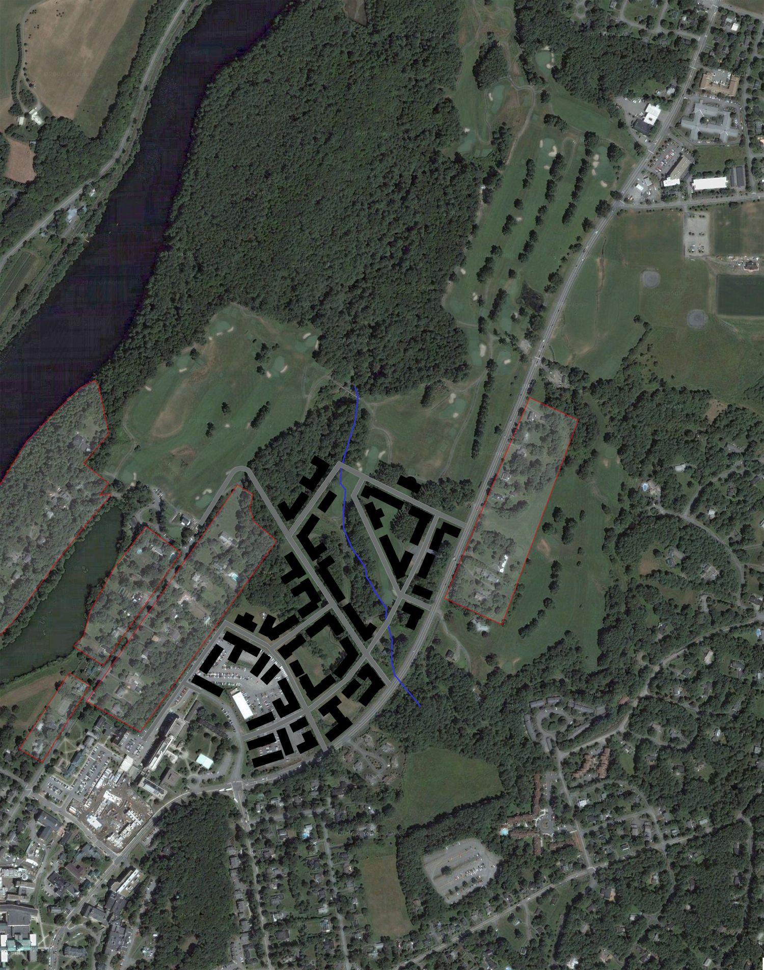
Various topics including two West End flythroughs

Insignia

Office of Communications, “Working Group Will Outline Best Practices for Iconography” (6 May 2021):

The Campus Iconography Working Group has begun work to draft recommendations for artwork, images, and nomenclature across Dartmouth’s physical and digital environments. The group, which includes students, faculty, staff, and alumni, will consider items such as paintings, sculptures, statues, and official insignia.

Contrast that project with the recent OCD overhaul of Dartmouth’s visual identity on an essentially graphical basis.

It seems likely that the group will recommend the retirement of Dartmouth’s 1944/1957 coat of arms, the familiar shield depicting a pair of Native Americans walking toward a college building (not Dartmouth Hall but a generic college or, at best, a Dartmouth Hall precursor).

Dartmouth's 1957 coat of arms

Jonathan Good’s Proposal for a Heraldic Coat of Arms for Dartmouth College anticipated this retirement decades ago and suggested an appropriate replacement.

It is important that Dartmouth, while retiring its current coat of arms, create a replacement coat of arms. There is a risk that the college will do nothing and that the D-Pine, a fine less-formal symbol particularly suited to athletics (notwithstanding its description by the Office of Communications as “the most formal brand mark”) will become the official symbol of Dartmouth College.


Any iconography decision will apparently not affect the naming of the Geisel School of Medicine (Inside Higher Ed).

Dartmouth NEXT, a sort of Great Issues for the world, uses the map (or really the pattern) of paths on the Green in a graphical way to form a right-pointing arrow logo:

Excerpt of Dartmouth NEXT logotype

A course exhibit from April 2020 titled The Indian Symbol at Dartmouth: A Story of Voices and Silence contains a number of notable documents from the archives. The 1932 article on “the new official insignia,” for example, is very interesting and brings to light an obscure design. One note: The Eleazar Wheelock Tombstone, which is carved (not stamped) with a version of the Indian head symbol, is actually a non-funerary monument located in Columbia, Connecticut. Wheelock is buried in Hanover, N.H.

The Hop is finally expanding — under Snøhetta

International architecture firm Snøhetta will design the Hopkins Center expansion, the college announced.

Part of the project will be the “[i]ntroduction of a new, more welcoming entry for ease of arrival and orientation,” but that is presumably a reference to what students consider the rear entrance, on Lebanon Street. The promotional page for the project states that conceptual designs will be finished this spring.

A bit of the back story: The college planning of the Wright era included a 2002 Rogers Marvel master plan for the arts district. It focused on expanding the Hop. Several years later (was it in 2010, with the Arts Center of the 21st Century symposium?), the Portland, Oregon firm of Bora designed a fine set of additions and interventions for the Hop. One image showed a new Lebanon Street entrance with a glassy curtain in place of the mute granite of the current blank porte-cochère. The school did not give the go-ahead, however.

By 2019, the Hop’s page at the Call To Lead campaign website was giving notice that “the selection of an architect partner will be unveiled as early as 2020” (Wayback archived copy). That must be Snøhetta. Apparently Arup has already completed an initial study.

This promises to be an exciting journey for a familiar and endearing complex. Construction designs are expected in mid-2022.

Various topics, including unbuilt buildings

  • An article in The Dartmouth notes the completion of work on Reed and Baker and the start of work on Dartmouth Hall.

  • The HGA [architects] page for the CECS building has an image showing main entrance with the name KEMENY HARDENBERG above the door.

  • The Goody Clancy page on the Irving Institute is up.

  • What might have been: The central and right-hand groups of images on Samer Afifi’s site show (1) a more traditionally-massed CECS on the site where it is now being built and (2) a very unfortunately sited Irving Institute way back on the River Cluster site — not only distant from any important campus axis but also blocking any further Tuck School expansion.

  • This has been noted here before, but it is always fun to see: A Kliment/Halsband-designed addition to the Shower Towers to house Sudikoff. It looks perfectly pleasant, but it must have been overtaken by VSBA planning for Berry Row.

  • Kellogg Auditorium, perhaps the only building at Dartmouth named for a room, has been renamed Kellogg Hall and renovated as a classroom building. It opened last fall (Susan Green, “Newly Renovated and Renamed Kellogg Hall Opens” (29 September 2020)).

  • Dartmouth News has a piece on the importance of the DHMC parking lot as a social space in pandemic times.

  • Many outlets, including the Concord Monitor, have written about the huge college-affiliated apartment complex that will be built on Route 120 at Mt. Support Road.

  • The Davison Block, a prominent and historic commercial building at the top of Main Street in downtown Hanover, has been sold by the Davison family, reports the Valley News.

  • The Valley News also had an article on a sort of Christkindlmarkt that was set up in Hanover over the holidays. Fantastic. So many nice touches could be added to downtown, especially on South Main Street above Lebanon Street, whether by raising the street level (happening?), adding bollards, or limiting traffic and parking. An inviting town square could be delineated in front of the Municipal Building.

  • The Valley News reports on the college’s pullback from the idea of a new biomass heating plant. This is probably good news for the preservation of the old smokestack.

  • There are some great photos in the annual roundup of shots by Dartmouth photographers. The aerial of Baker Lawn does look like a De Stijl painting, as noted. It might look even more like a work in batik, an impression created by the imperfections in the edges of the paths and the snow-covered roofs.

Hilton Field as a sculpture park

Here is a thought: What if, instead of calling for an arboretum on the former golf course, the master plan (see the post here) proposed to construct a large sculpture park? A sculpture park on Hilton Field, the part of the golf course that lies north of Occom Pond, would have little more impact on the neighbors than would an arboretum. It would be managed by the Hood Museum as a site for major new works, and it could provide a home for any refugee works that the college thought appropriate to move from the campus, such as Thel (see the article here; the master plan at least hints at the possible removal of Thel).

Speaking of Thel, here is William Blake’s new gravestone in Bunhill Fields Burial Ground in London. It was created by the Blake Society under the leadership of Philip Pullman, of His Dark Materials fame.

Photo of grave of William Blake in London by Scott Meacham

The Anonymous Hall bridge (see photos at the Windover Construction site) deserves praise for adding to the walkability of the northern part of the campus. It seems like the sort of amenity that could easily be cut from a construction budget.

Let’s hope the proposed cemetery bridge (see the final image at the BBB master plan project page for a conceptual view) eventually is built, and when it does cross the burial ground, let’s hope it receives an appropriate amount of design attention. What a fantastic project this could be, and what a great opportunity for an architectural commentary on the influence of ancient Egypt on both bridges and funerary architecture. See for example the post here for a proposal to erect an ominous cemetery gate at each end of the bridge.

Egyptian Revival architecture makes for a good folly; authors Gwyn Headley and Wim Meulenkamp have a new book out called The English Folly: The Edifice Complex. Their earlier book, Follies: A Guide to Rogue Architecture in England, Scotland and Wales, features a photo of the Dunmore Pineapple in Scotland (Wikipedia) on its cover. Yes, that Dunmore: the building’s patron, John Murray, was the Governor of Virginia at the beginning of the Revolution. On December 6, 1775, Murray wrote to (that) Lord Dartmouth to say that “I immediately ordered a Fort to be erected” at Great Bridge, on the edge of the Great Dismal Swamp (pdf, 1311). The utilitarian and hastily-built timber stockade called Fort Murray was pretty much the opposite of a folly; it withstood a rebel siege but no longer exists.

The master plan: further reactions

See the previous post on this topic.

The two locations of Geisel

The new-look Remsen/Vail at the north end of campus is an improvement and looks like the work of Leers Weinzapfel Architects, the designers of the reskinned Dana Library/Anonymous Hall adjacent (page 44 of the plan).

Remsen-Vail
If the Geisel School of Medicine were to relocate to new facilities, this opportunity for adaptive reuse can accommodate up to 550 undergraduate student beds and/or academic space, and could include new facade materials, enlarged windows, and a welcoming new entrance.

One might have no particular objection to the architecture but still recoil at the idea of placing undergrad beds or academic space this far away from the center. Undergraduate uses do not belong this far north. As a ten-year swing space allowing the rehabilitation of other dorms, perhaps, but it is just too far away.

The larger point here is that Geisel seems uncertain about its location. That the school is split between its traditional home here at the north end of campus (including its fancy admissions office in a renovated 19th century hospital ward) and its technical and efficient home alongside the suburban hospital south of town has always seemed strange. Students begin their education in Hanover and conclude it at the hospital in Lebanon.

Whether this split the result of intention or of nothing more than the lack of a replacement for Remsen/Vail at the DHMC campus, the plan suggests that Geisel could leave Hanover and make its DHMC site a true and complete med school campus. If that happens, it would be hard to argue that the vacated Geisel buildings in Hanover should not be used by Dartmouth (although a similar argument was successful in the past, when most of the hospital complex was demolished; VSBA had suggested that the Modernist main tower, at least, be renovated as a dormitory).

The proposals for a med school campus at the south end of the DHMC complex are so sensible as to raise the question of why they have not been built or at least planned already. A main building, some housing, and a modest green space for a medical school? Perhaps it is a measure of the committed suburbanity of the hospital complex that such a thing has not been accomplished thus far. The Geisel campus can grow as a grid of independent buildings flanking outdoor spaces rather than as the nucleus of a radiant sunburst of parking lots.

The Grand Limited-Access Road

New limited-access roadway for shuttles, emergency vehicles, and bicycles connecting Sachem Village and DHMC.

The transit link across the woods between Sachem Village and DHMC stands out as completely obvious and necessary, even to someone who knows the area only from maps.

Is the access limitation placed on the road because it goes through the residential neighborhood of Sachem Village? If there were some way to make it a proper road, it could take a lot of pressure off downtown Hanover. Yes, limited-access streets are pleasant and necessary — perhaps South Main Street above Lebanon Street? — but preventing this road from handling traffic seems cruel to Hanover.

The future has already arrived in the West End

Not much is novel here because there are two major buildings currently under construction. The rest of the area, while populated with buildings from the Sixties and Seventies, is still something of a blank slate. West End Green might be a bit vague (trees will do that) but it is an improvement.

Speaking of the Tuck School, it always seems to be threatening to leave:

In the future, the Tuck complex could be renovated and expanded to advance its competitive edge. Or, if relocated to new facilities, Woodbury and Chase, originally built as student housing, as well as Tuck Hall could be repurposed for undergraduate
housing, providing up to 230 beds.

Putting undergrad beds in the Tuck complex would be a neat trick, but moving Tuck out to some shiny, flimsy complex at an isolated forest site in Lebanon would be a blow to Dartmouth.

Does the college need to give a territorial guarantee to keep Tuck on campus, perhaps a promise of a portion of the future sites around West End Green and an access corridor or exclave on West Wheelock Street, a B-School Kaliningrad?

Minor points

  • What is the unlabeled property to the northwest on the map on page 5? It is the college-owned woods in Corinth, VT (see page 60).

  • The Covid-19 information in the master plan makes for a timely preface but already seems a bit dated in this 30-year plan.

  • “Gibson” is spelled “Givson” on an image on page 36.

  • “Hanover Campus” is inconsistently capitalized. The version with a lowercase “c” seems preferable.

  • Calling it “the College Park BEMA” is odd. There is no other Bema to confuse it with, so “the Bema” or “the Bema in College Park” would suffice. And “BEMA” does not need to be in all capital letters — the word “BEMA” in caps is a backronym (a back-formed acronym) for Big Empty Meeting Area, and as such makes a cute campus legend, but the Greek-derived word after which this space is named is “Bema.”

  • Is it strange to call it “Mount Moosilauke Ravine Lodge”? The mountain is Mt. Moosilauke and the lodge seems like it should be called the Moosilauke Ravine Lodge.

  • The map on page 9 showing new nodes hopping around campus is neat and insightful, but it could make its point even more strongly if it showed Thayer School’s time in Bissell Gym (on the Hop plaza, basically) from 1912 to 1939. And if the map substituted Geisel for MHMH, it could show three nodes instead of two: first the Medical School (on the Burke Lab site, from 1812 to the 1950s[?]), then MHMH, then the hospital complex in Lebanon.

The master plan: initial impressions

See the latest version of Planning for Possibilities on the Presentations and Outcomes page. So far, the October 2020 draft plan and a slide deck have been posted.

The new master plan is very impressive.

The scope of the plan is impressive. It is the first master plan for the college to at least account for all college properties (the map on page 5 is zoomed out so far that it shows part of Canada) and the first plan to frame the campus in a regional context. Especially where transit is concerned, the Organic Farm and DHMC really do need to appear on the same map.

The document is more readable and less technical than its predecessors. Its creators made the interesting decision to use oblique aerial views exclusively — meaning that none of the proposals for development appear as flat “plans.”

The potential projects on campus look excellent. Placing a building on the lawn of Shabazz Hall makes so much sense. The natural site for a new physical sciences building beyond Burke of course requires yet another demolition of Dragon. The proposals for Bartlett and Wheeler additions are fantastic, with the latter being particularly bold. The natural row behind Mass Row could incorporate an abutment of, or at least an entry plaza for, the Cemetery Bridge at its south end. The Bema pavilion makes sense (maybe the place will see more use if it has a proper covered stage?), though erecting a frame building would be unusual in that space.

One might wish the planners had considered building on the vacant lots in front of Sanborn and south of Blunt as well. And why not show a building site on Berry Row between Kemeny and Moore? It has always been planned that way, even going back to VSBA days after the purchase of the hospital property. Oh well. (The plan also does not clearly note the anticipated Ledyard Canoe Club replacement, but that is not important.)

Here’s hoping that the college preserves the old frame buildings that are now standing on the various development sites. There are two buildings on the site behind Mass Row, two on the Choate Road corner, two in front of Thompson, and two on College Street next to Sudikoff. There is also a certain amount of appeal to the idea of saving Sudikoff itself, the village-like assemblage of brick house-forms, and of saving Raven, but neither building is of a scale to stand up to Moore Hall next door. Clearing the Sudikoff corner is the breaking of eggs to make an omelet in this plan.

The big question: Hilton Field (the western portion of the golf course)

The plan proposes that the oldest portion of the shuttered golf course be turned into an arboretum. This is a clever choice, especially given the neighborhood and its sensitivities. An arboretum really is typologically and functionally similar to a golf course or, for that matter, a city park or a cemetery. In the end, this minor change in use might amount to nothing more than ceding the land to nature as at the adjacent (and intermingled!) Pine Park. And yet an arboretum will not take Hilton Field off the table for some distant future development if it is needed. Still, the college would probably be remiss not to put a half-dozen houses for sale to faculty along Hilton Field Road at the same time it lays out the arboretum. What an opportunity!

East and North of the Green

The Thel sculpture is not mentioned, but it might be endangered:

Fairchild Field
A new shared surface for cars, pedestrians, and bikes, in lieu of a vehicular access road, creates better pedestrian connections between the Physical Sciences Complex and the Historic Core.

Anything that replaces the access road would be an improvement.

The plan devotes a great deal of attention to Fairchild Tower. It proposes a new interior stair and a bridge (to Wilder, presumably). Fairchild has always seemed a chilly, hollow signpost, but the illustrations in the plan remind us of how stylish it is.

Moving south across Wheelock Street, the big Vox Lane redevelopment image shows McKenzie and the Store House as not only preserved but expanded vertically into a “wellness” building — fantastic. That will be one of the most architecturally interesting buildings on campus. (This proposal was not included in an August presentation image and thus seems to be a recent inspiration.)

South of the Store House is shown a parking garage on the FO&M corner. Fine, but one hopes that it will have retail uses on the ground level. It could make for a neat visitor entry to campus: you drive to town, park in the garage, follow the signs to the back door of Wilson Hall — the new admissions office, in this plan — and when you embark on your campus tour and pass through Wilson’s great arch you see the Green laid out before you.

It is good to see the athletics promenade alongside Leverone (page 52). And Piazza Nervi is on the map, described this way:

Park St Gateway
A gracious gateway to athletics and the campus visually connects the Leverone Fieldhouse and Thompson Arena, both historic modernist structures designed by Pier Luigi Nervi.

That “gateway” project would move the two houses currently blocking the view of Thompson Arena and, interestingly, would add a roadway in front of Thompson. Clever: lining a lawn with streets sets it off as a public space, a public green.

North Campus

The architects’ image of a Maynard Street Green on page 45 looks like a Currier and Ives print.

The plan mentions the possibility of moving all existing uses out of the Rope Ferry Road buildings and turning the buildings into graduate dorms. Interesting! But wait, do they mean vacating Dick’s House too? They do, apparently — which would be too bad. Would there be any infirmary on campus, or have student health services become a collection of vending machines? Presumably the infirmary would go to the “wellness” building at McKenzie. If that is what it takes to save McKenzie, then so be it.

And beyond: Land banks on Lyme Road

The new buildings north of the Class of 1978 Life Sciences Center are a great start, and there could be many more here. Dewey Lot has so much space, as stated in the report, and so much potential. The depression here creates a fantastic opportunity for an extensive below-grade parking deck. As stated on this site in the past, however, the functions placed here should not be college-related. This is no more a part of the campus than is the CVS (Grand Union) building, and college ownership of this site does not change that fact.

Moving up along Lyme Road outside of town: The two alternative land bank locations labeled “Site 1” will inevitably be suburban and oriented to Lyme Road, notwithstanding the plan’s idealism about self-driving cars. They really will have parking lots, because they will become office parks and convenience stores. As far as the choice between near and far, the farther site, next to the fire station, seems preferable. There is less chance that it will contain anything that undergraduates would need to visit.

More on the two locations of Geisel, the Grand Limited-Access Road, and the rest of the plan in a future post.

The big renovation of Dartmouth Hall is beginning

The Trustees have given the go-ahead (Valley News, Dartmouth News) to start the big renovation of Dartmouth Hall (design page). Apparently the project was moved up by a year because the relocation of faculty offices from the building was unexpectedly spurred by the pandemic.

Dartmouth Hall, it will be remembered, was designed by college architect Charles Alonzo Rich ’75 and was built from 1904 to 1906. Successor college architect Jens Fredrick Larson designed the gut-remodeling of the building that took place in 1935 and 1936, in which the current concrete floors and steel stairs were installed and Room 105 was created. The small gables over the north and south entrances bear the years 1904 and 1935 in reference to these construction periods. The year 1784 in the central gable refers to the original Dartmouth Hall, which stood on the site.

The most notable change in this latest renovation will be the extension of the existing granite foundation as a podium or terrace in front of the building. The three sets of steps will be there, and a ramp will be integrated into the south end of the terrace. The composition seems fitting and will probably go unnoticed by most observers.

Other changes: The building’s center doors will be made operable and will continue to give on to the shallow lobby of Room 105. In the College Yard, an east-west path leading to the center entry will return, and a new diagonal path will make the slope accessible. The rear facade will have ramps and stairs for the north and south entrances protected by simple if not utilitarian shed roofs.

The campus master plan!

A draft of the strategic master plan, Planning for Possibilities (PDF), was released last month without fanfare:

Master Plan cover

The document contains a lot to talk about. Commentary here will be forthcoming, but for now the key word is Arboretum. More information from the Strategic Planning Team is available on the Presentations page, and Director of Campus Planning Joanna Whitcomb will be giving an on-line presentation on November 11 at 7pm (register).

—————-

[Update 11.11.2020: The plan was presented to the Trustees’ Master Planning & Facilities Subcommittee in August (cached page), and a short version of that presentation is available in PDF. That document shows some interesting Sasaki renderings of a Choates addition and the Crosby Street dorm that did not make it into the current plan. The current draft plan, along with an audio slide deck from May, were released on the Presentations page ahead of the November Trustees’ meeting, and the Board approved the master plan last week (Dartmouth News).]

The College Street sidewalk and other topics

  • The college is replacing some of the glass curtain walls on the Black Family Visual Arts Center, including the large etched glass window that clad the upper levels of the building over the west (campus) entrance (former link). The replacement glass here and over the south entrance will be less distracting and provide better management of daylight. The etched design over the west entrance, however lovely up close, did always look from a distance like creeping frost or condensation inside a multipane window whose seal had failed.

  • Very interesting: the college is putting a lot of effort into installing a sidewalk along College Street north of the site of the old DG House (see North College Street Sidewalk weekly update). Sidewalks are good, and this one must have been deemed necessary, but there was something romantic about the way College Park spilled wildly toward the shoulder of the road, untamed. Just look at this barely-trammeled wilderness, as seen in Google Street View during July 2019:

    At any rate, the project involves what appears to be a hand-laid stone retaining wall intended as a counterpart to the existing wall to the south. (Does that existing wall incorporate foundation stones from the Victorian DG House?)

  • Dartmouth News has a video on the wooden sculpture by Ursula von Rydingsvard called Wide Babelki Bowl that now stands northwest of Rollins Chapel. (It is not really a southern counterpart to Thel; that honor was held by Telemark Shortline, which has been removed.) As Jessica Hong notes in the video, the sculpture has a definite kinship with the cyclopean masonry of Rollins; it is also reminiscent of the multi-stone sculptures of Angkor Wat.

  • The college is going ahead with the DOC House renovation (project page) with funding from the Class of 1969. Compare the project page image with the image at The Call to Lead to see the exterior changes on the Occom Pond facade.

  • It is not clear if there is an earlier public mention than this April 20 article, but the trim Sports Pavilion by Burnham Field that was built in 2007 and expanded a decade later has finally been given a name: Reilly Pavilion.

  • Housing developer Michaels Student Living will build an $84 million graduate student housing complex on Mt. Support Road, near the hospital, in coordination with the college (see renderings in Dartmouth News release, site plan in The Dartmouth). The designer is JSA Design of Portsmouth (Boston Real Estate Times).

  • The Valley News reports that plans are afoot to save the Hanover Country Club as a nine-hole course. The northern two-thirds of the course, comprising holes seven through 15, would be used in the new course; the southern portion of the course, lying south of the bulk of Pine Park and including the clubhouse area and the bridge over Girl Brook, would be made available for possible college expansion.

  • The Valley News has a story on a new cold chamber to be built at CRREL.

  • The steel frame of the Irving Institute has been topped off (Dartmouth News).

  • Most construction projects, including the construction of a large dormitory at the corner of Crosby and Wheelock Streets, are on hold, reported The Dartmouth in June.

  • Vermonter Putnam Blodgett ’53 died on March 20 (Valley News). He led the Moosilauke advisory committee, and his woods were the source of the unique forked white pine called Slingshot that supports the second-level bridge as well as the roof of the new Ravine Lodge (see photos in Jim Collins, Welcome to the Woods, DAM (Jan-Feb 2018)). I recall him at the 1995 Senior Symposium talking about the 1949 Tug of War: apparently the regular tug of war between the freshmen and the seniors had come to be seen as too large and dangerous, so the college placed a huge log between the opposing teams and attached multiple ropes to each side. Unfortunately, one of the ropes came loose and the log went flying in the opposite direction, toward the side with more pulling force. He said it was a miracle that no one was badly injured.

  • A ring bearing the letter “Z” featured prominently in a photo in the July 24 Washington Post story on the Pebble Mine project in Alaska. The photograph, by Alex Milan Tracy, showed the right hand of then-CEO Tom Collier, a U.Va. graduate. It’s a safe bet that the ring indicates membership in the Z Society (Wikipedia).

The end of the Hanover Country Club

Along with ending five varsity sports, the college is closing the Hanover Country Club after nearly 125 years (see the announcement, which features another great Burakian aerial; see also the more detailed Hanlon message and the FAQ).

The golf course has been thought of as a land bank, a reserve for future development, for decades. A thorough college planning process can be expected before anything is built on the golf course.

Here are some suggestions for the plan:

  1. The historic clubhouse, a 19th-century barn that was extensively remodeled by Professor Homer Eaton Keyes in 1916 and 1917 (a post here), should be preserved, ideally on its current site. It could be expanded and turned into a dwelling.

    Hanover Country Club House, Dartmouth College
  2. If the golf course is going to be developed, it should be developed thoroughly. Piecemeal scatterings of parking lots and isolated buildings will only draw suburban sprawl closer to Hanover (a concern expressed in a 2008 post here). The college should plan for an all-encompassing, long-term project that reserves important natural areas, establishes a street grid, and envisions buildings surrounding walkable public spaces.
  3. More to the point, the development should be urban, not campus-like. The golf course lies outside the 10-minute walking radius of the college, and none of the buildings built there should contain spaces for instruction or student dining or living. These should be mixed-use commercial buildings like the ones found in Hanover’s first downtown, South Main Street. That is the idea presented in a 2012 post here that featured this image:

    north block proposal
  4. One exception to the no-campus guideline might be made for a new business school campus. Professional schools are located at the edges of the college, and the Tuck School has looked in the past at new sites along Lyme Road — which is too far away. A new Tuck campus beginning behind the Life Sciences Center and extending up into the golf course could be impressive. Thayer School might be happy to take over the old Tuck buildings.
  5. While commercial buildings extend northward along Lyme Road, what kind of construction should the college promote on old Hilton Field, the area beyond the DOC House and the Clubhouse? To bring some income, provide needed housing for academic families, and appease the existing neighbors, the college might want to consider building houses here in the character of the historic neighborhood.

Symbols, including weathervanes and flags

Baker Tower Weathervane. The Valley News has been reporting on the petition calling for the removal of the Baker Tower weathervane and the college’s plan to remove it (see also Dartmouth News). A crane crew removed the weathervane on June 25 (Dartmouth News).

The college plans to create a replacement; George Hathorn has suggestions. The June 25 Dartmouth News piece by Aimee Minbiole states that “Vice President for Communications Justin Anderson will assemble a working group to consider designs for a new weather vane and whether other changes in iconography across the institution are necessary.” If that iconography includes the college seal with its depiction of Native Americans, one solution would be to adopt an heraldic seal based on an heraldic coat of arms.

The cascading effects of the weathervane’s deprecation are interesting. The Guarini shield, less than a year old, contains the tiniest imaginable depiction of the weathervane, but it will apparently be changing. (It is even less visible than the Indian head cane that was removed from the pre-2012 DMS shield.) The Town of Hanover is also changing its official logo, which contains a line drawing of Baker Tower that also features a small version of the weathervane. Remarkably, the Valley News story, citing Town Manager Julia Griffin, states that some variants of the town logo already render the two human figures as trees: “Griffin said via email that many of the logos in town show three pine trees on the weather vane, rather than the more troublesome figures. For now, those logos won’t be changed, she said.”

The original 1928 copper exterior of the Baker Tower weathervane is already in storage. The exterior was recreated, according to the Valley News story of June 12, as part of the tower renovation project of 2016, less than four years ago. Compare that missed-opportunity-in-hindsight to the travails of U.Va., which updated its athletics logo in April and two months later finds itself tweaking the new design to get rid of the twisted hilts of the crossed sabers. What is the symbolic significance of a twisted hilt? It is not clear that it has any independent meaning at all, but the promotional verbiage that was put out with the spring update pitched the twisted hilts as a reference to the serpentine walls that line the back gardens of the university’s original buildings. Those walls’ connection to enslavement is the prompt for the latest change.

(One would think that the bigger problem is the association with the Confederate cavalry saber — the crossed, curved cavalry sabers are much more typically seen as an emblem on a mid-19th century slouch hat than in connection with a 17th-century cavalier — but the designer of the U.Va. logo in the mid-1990s says he did not intend it to refer to the Civil War.)

Flags. A lot is going on with flags these days. Mississippi has dropped its flag and will consider the Stennis Flag among the possible replacements. The 9/11 “Freedom Flag” (spotted in the wild here) is the subject of a bill, sponsored by Reps. Spanberger and King, proposing to make it the official flag of 9/11 remembrance (WTVR News). The flag is to be flown on federal buildings from September 11 through 30 each year. Finally, CNN has a piece on the Juneteenth Flag. Maybe looking at the Freedom Flag encourages one to view every flag as a map, but the zig-zag “burst” lines on the Juneteenth Flag can also be read as the plan of a 19th-century star fort. One might prefer a version of the date that omitted the comma, but the specificity of putting the date on the flag in words is appealing.

Other symbols, including plaques. There is an official climate emergency tartan (Scottish Register of Tartans). The FCC has a new seal (see Brand New, also FCC announcement pdf). The eagle has post-Homeland Security wings; the antenna feed line, which curved realistically in the old FCC seal, is made into a rigid line of division of the shield — ouch.

Finally, because this site is always on the lookout for a rogue plaqueing, a link to Kevin Levin’s Civil War Memory post on the series of unofficial historical markers erected by activist historians on Monument Avenue in Richmond. Some of the markers apparently have been ripped up already (WTVR News). Three of the four city-owned statues of defeated rebels have been removed in recent days, and only Stuart remains. Here is a windshield snap taken yesterday; the statue is not expected to last another week. It does feel like Europe in 1989:

Stuart statue by Meacham 07.03.2020

Crosby Street dorm off the table and other news

  • The construction of the Indoor Practice Facility is nearly finished (see Big Green Alert). The school’s existing indoor practice facility, Leverone Field House, is being eyed as a site for a temporary hospital ward during the pandemic (Valley News). The west wing of Alumni Gym is also under consideration (Valley News).
  • This interesting tidbit appeared at the end of a board news release about new trustees:

    The new board members were elected at the board’s spring meeting, held this year at Stanford University in Palo Alto, Calif.

    That seems like a first. The main news release (issued 1 March) has more information:

    The board met at Stanford University in Palo Alto, Calif., where they engaged in wide-ranging conversations with a diverse group of Stanford leaders including trustees, the former and current presidents, the provost, faculty in leadership positions, and representatives from departments across campus.

    Not sure what to make of that, whether the learning opportunities were added to enhance the remote meeting or the meeting was held on the other side of the continent specifically in order to learn from Stanford.

  • Shattuck’s Revenge. At the Stanford meeting, the board approved a capital budget to fund projects that include “include renovation of Thornton Hall; planning and design of the Dartmouth Hall renovation; planning for proposed projects with private developers, including graduate housing and energy infrastructure; and” other projects. An interesting mention is made of $3 million “for planning and schematic design to explore the renovation and expansion of the Choates residence halls and the East Wheelock residential complex,” and funding for the future Hop renovation (still on the table!) and construction of teaching and research spaces is also noted. Not a word, however, on the Crosby Street dorm, which has been in planning for more than two years now. The project page for the design of the building was quietly removed from the Campus Services website during the last few weeks.
  • Irving Oil Co. has a rendering of the Irving Institute that differs in detail from the other images out there.
  • The college launched its capital campaign two years ago at Duggal Greenhouse in the Brooklyn Navy Yard. Some photos from the event show considerable attention to detail: the use of Dartmouth Ruzicka lettering on the front facade; the model (15′ high?) of the bonfire, reimagined as a cocktail table; and the plaster/pasteboard renderings of Baker Tower and the main buildings of Tuck, Thayer, and Geisel (it’s white, but it’s a reasonably accurate rendition of the school’s ex-hospital building on Maynard Street).
  • Unrelated even to architecture: Although it is not unusual to hear of a company that has been operating since 1905, it is unusual to find one that has been making the same product since its beginning. How odd would it be if that product were a Morse code key? Take a look at Vibroplex and its Original Standard key. This is not quite an example of Ferry Porsche’s theory that the last car ever to be built will be a sports car (see Porsche’s site), because the FCC seems to effectively subsidize the use of Morse Code by prohibiting other modes of communication on certain radio frequencies, but it is close.

The new Guarini shield

The Guarini School of Graduate and Advanced Studies has a new shield by OCD.

The prior shield (see the post at this site) was adopted in 2011 after a low-budget crowdsourcing project. It shows the mandatory river lines in the base as a pair of helping hands, a bit reminiscent of the United Way logo. Some versions of the shield included the year 1885, when the first graduate degree was awarded at the college.

The new shield displays the year 2016, the year the school was formally established, in the base. It is not clear whether the sans serif typeface is the required National 2, but the extra height it gives the numeral 6 suggests that these numerals were not hand-drawn.

Above the year are the waves of the river, and on the left side of the shield, emerging from the river — not yet swamped! — is the upper portion of the cupola of Baker Tower. This might be called the Day After Tomorrow shield. Stanley Orcutt’s Wheelock and an Indian under the Pine weathervane bumps up against the very thick border of the shield, and the rest of the shield is occupied by a representation of the constellation Cassiopeia, as the news item explains:

The designers worked with the School to create an image of Cassiopeia, one of the constellations that one could have seen when standing on the green at midnight and looking north at Baker on the night the Board of Trustees voted to establish the School, on July 1, 2016.

The fine line between clever and stupid

  • A new site plan for the new dorm by the gym shows some refinement. The “bridge” element facing Crosby Street looks like the main entrance and responds to what planning analyses have identified as a major pedestrian route — the parking lot of the Heat Plant and Vox Lane. That’s nice, and one hopes the emphasis on this route helps cement the place of McKenzie and the Store House. But a good percentage of visitors to the new dorm will be arriving at the front of the building, at the Wheelock Street corner. No path is shown there. The construction timeline states “Commence Completion of Design phase – dependent on fundraising.”
  • Dana Biomedical Library, reconstructed as Dana Hall, has been renamed Anonymous Hall (Dartmouth News, Valley News). Unlike, say, Nameless Field at U.Va., the building does not lack a namesake; its namesake is simply undisclosed. What would be an unfunny move if committed by the administration might be saved by the fact that it was requested by the donor of the renovation. The Guiarini School (formerly the School of Graduate and Advanced Studies) is headquartered in Anonymous Hall. The building contains a DDS cafe called Ramekin Cafe.
  • More Irving renderings are available and a time-lapse video of construction is on line.
  • Dartmouth Ruzicka is being rolled out on the school’s websites, a December article explains.
  • Berry Mall has been torn up as part of the project to extend utilities to the west end of campus.
  • The maples on the south end of the Green are coming down. They did always seem a bit diminutive for the space; too round in comparison to the elms, or something.
  • An article in The Dartmouth explains the Fifty.
  • A well drilled on the Green is being tested for use in a geoexchange system like the one in use at Fahey-McLane.
  • A Valley News article on the projected library storage building.
  • Lawrence Biemiller has a bit on the Hood in a post on lessons that campus buildings have taught.
  • The college is in a partnership with a developer to build hundreds of apartment units for graduate and professional students near the hospital (Union Leader, Dartmouth News). It is hard to imagine how this could be anything but sprawl, but we will see.
  • BGA Daily has photos of the indoor practice facility. It looks like the renderings! One does hope that the building will connect to the brick gateway of Scully Fahey Field, although it looks doubtful. There is a curious kind of preservation going on with the brick pier of the Boss Tennis Center: BGA Daily photo.
  • An article on the new painting at the Skiway.
  • Rauner Library has an exhibit on slavery at Dartmouth.
  • The Reed Hall renovation designed by EYP is beginning (Dartmouth News).
  • Some U.Va. students are saving the old card catalog that was being removed from the main library building (Washington Post), and the U.Va. administration is starting a campaign of plaques, markers, and tours focused on the history of the institution.
  • If you enjoy Kate Wagner’s McMansion Hell, you’ll enjoy her “Duncing about Architecture” in the New Republic, about a proposed executive order titled “Making Federal Buildings Beautiful Again.” The group behind the proposed order, National Civic Art Society, counts the founder of Joe’s Dartblog among the members of its board of directors.

———-

Update 02.09.2020: NCAS item added.

Master plan coming soon

The school has put out to bid a $50 million master plan project. The note says “Owner reviewing development options – Master Plan presentation planned for November 2019.”

The planners have been doing an impressive amount outreach, and there is a page listing various presentations. The Valley News has a November 8 article on the plan and its pending release, and the college news has coverage.

Most interesting is a Berry Main Hall exhibit (pdf) from November. It has very nice maps, including one showing some 30-year landscape opportunities with perspective views. Mass Row has an appropriate mirror dorm behind it, removing North Fairbanks, but maybe we can presume that South Fairbanks will be saved. The best one by far shows the Fairchild area, and it finally, finally, gets rid of the curving suburban driveway that destroys the quad between Wheeler and Steele. It even hints at the removal of Thel though one doubts that such a thing is likely or even necessary.

The plan is bold enough to mess with the town, showing South Main as a bike-friendly zone. The plan counts on the existence of the future cemetery bridge, which is good to see. It proposes a neat path network running east of Lyme Road, heading up to the Rugby Clubhouse and so on. The public release of the complete plan is scheduled for this winter.